IMAGES TAKEN NEAR TO
Long Leasow, TELFORD, TF7 5GE
Introduction
This page details the photographs taken nearby to Long Leasow, TF7 5GE by members of the Geograph project.
The Geograph project started in 2005 with the aim of publishing, organising and preserving representative images for every square kilometre of Great Britain, Ireland and the Isle of Man.

There are currently over 7.5m images from over14,400 individuals and you can help contribute to the project by visiting https://www.geograph.org.uk
Image Map
Images are licensed for reuse under creativecommons.org/licenses/by-sa/2.0
Notes
- Clicking on the map will re-center to the selected point.
- The higher the marker number, the further away the image location is from the centre of the postcode.
Image Listing (8 Images Found)
Images are licensed for reuse under creativecommons.org/licenses/by-sa/2.0
Image
Details
Distance
1
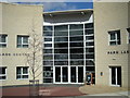
Entrance to the new Park Lane Community Centre, Woodside.
Image: © Row17
Taken: 4 Mar 2008
0.16 miles
2

Woodlands Primary School
...in Woodside, for 5-11 year olds. Situated just across the car park from the Community Centre.
Image: © Steve McShane
Taken: 12 Nov 2005
0.17 miles
3

The (former) Rough Park Riding School house
With its origins in the late 18th century, this rather grand former house was used until fairly recently as the base for a horse riding school. It was Grade II listed https://britishlistedbuildings.co.uk/101033292-rough-park-riding-school-madeley#.XiSyA2j7TIU & https://historicengland.org.uk/listing/the-list/list-entry/1033292 in 1983, and is now the centrepiece establishment in a development of houses that are being built around it.
Image: © Richard Law
Taken: 5 Jan 2020
0.18 miles
6
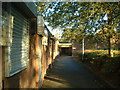
Woodside Community Centre
The usual 60s/70s type of community centre, in among the Woodside estate.
Image: © Steve McShane
Taken: 12 Nov 2005
0.21 miles
7
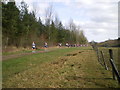
"The race now approaching Lightmoor Junction..."
"... will not be stopping, on the whole" because this section is all downhill, and therefore quite easy. The uphill bit along the Silkin Way near Blists Hill is a different kettle of fish.
Image: © Richard Law
Taken: 21 Mar 2010
0.22 miles