The (former) Rough Park Riding School house
Introduction
The photograph on this page of The (former) Rough Park Riding School house by Richard Law as part of the Geograph project.
The Geograph project started in 2005 with the aim of publishing, organising and preserving representative images for every square kilometre of Great Britain, Ireland and the Isle of Man.

There are currently over 7.5m images from over 14,400 individuals and you can help contribute to the project by visiting https://www.geograph.org.uk
The (former) Rough Park Riding School house
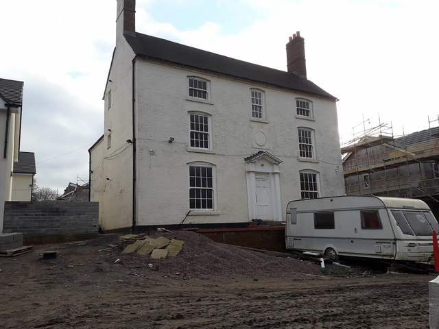
Image: © Richard Law Taken: 5 Jan 2020
With its origins in the late 18th century, this rather grand former house was used until fairly recently as the base for a horse riding school. It was Grade II listed https://britishlistedbuildings.co.uk/101033292-rough-park-riding-school-madeley#.XiSyA2j7TIU & https://historicengland.org.uk/listing/the-list/list-entry/1033292 in 1983, and is now the centrepiece establishment in a development of houses that are being built around it.
Images are licensed for reuse under creativecommons.org/licenses/by-sa/2.0
Image Location
Latitude
52.640647
Longitude
-2.468125