
IMAGES TAKEN NEAR TO
Old Nursery Close, TELFORD, TF7 5EZ
Introduction
This page details the photographs taken nearby to Old Nursery Close, TF7 5EZ by members of the Geograph project.
The Geograph project started in 2005 with the aim of publishing, organising and preserving representative images for every square kilometre of Great Britain, Ireland and the Isle of Man.

There are currently over 7.5m images from over14,400 individuals and you can help contribute to the project by visiting https://www.geograph.org.uk
Image Map
Images are licensed for reuse under creativecommons.org/licenses/by-sa/2.0
Notes
- Clicking on the map will re-center to the selected point.
- The higher the marker number, the further away the image location is from the centre of the postcode.
Image Listing (70 Images Found)
Images are licensed for reuse under creativecommons.org/licenses/by-sa/2.0
Image
Details
Distance
1
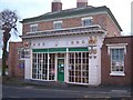
Madeley High Street Shop
Ornately decorated shop front.
Image: © Roger Dean
Taken: 22 Dec 2005
0.03 miles
3
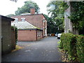
The Villa, Madeley
Hidden away to the north of the High Street, and quite securely fenced off as it's a nursing/care home now, The Villa is originally an early 19th century town house, which was Grade II listed https://britishlistedbuildings.co.uk/101208793-the-villa-madeley#.W9LpCdQrLGg in 1983.
Image: © Richard Law
Taken: 8 Sep 2018
0.06 miles
4
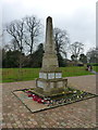
Madeley War Memorial
Carved of Portland limestone, and erected in 1920 in memory of local men who succumbed to the First World War. It was amended after WWII, and Grade II listed https://www.britishlistedbuildings.co.uk/101438118-madeley-war-memorial-madeley#.Wt7Qk_nwaM8 in 2016.
Image: © Richard Law
Taken: 7 Apr 2018
0.08 miles
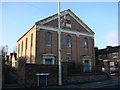
6
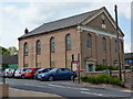
Madeley Wesleyan Chapel
Built in 1841. There was a lot of building activity in the Madeley area around that time; it must have been based on the coal mining and ironworks of the nearby Ironbridge Gorge.
Image: © Richard Law
Taken: 15 May 2010
0.08 miles
7
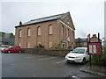
The Fletcher Methodist Church, Madeley, in 2018
Also seen here Image in 2009, and Image in 2010. The church was built in 1841 and Grade II listed https://britishlistedbuildings.co.uk/101208751-fletcher-methodist-church-madeley#.W9LS_tQrLGg in 1983; it's currently looking for a new use, judging by the boarded windows.
Image: © Richard Law
Taken: 8 Sep 2018
0.09 miles
8
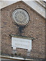
Plaque and window detail - Wesleyan Chapel
Image: © Richard Law
Taken: 15 May 2010
0.09 miles
9
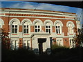
The Anstice Memorial Hall
The Anstice Institute and Memorial Hall was opened in 1870. The original building was destroyed by fire and was almost entirely rebuilt before it reopened in 1875. It is a memorial to the proprietor and manager of the Madeley Wood Company.
The building included a library, reading area and a lecture hall. It has been altered since and has formerly been used for dances, meetings, plays, concerts and social occasions.
It is now a member's club for drinking and bingo sessions.
http://www.british-history.ac.uk/report.asp?compid=18067. Date accessed: 15 November 2005.
Image: © Steve McShane
Taken: 12 Nov 2005
0.09 miles
10
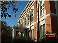
Anstice 2
A side angle of the frontage to The Anstice.
Image: © Steve McShane
Taken: 12 Nov 2005
0.09 miles