
IMAGES TAKEN NEAR TO
Upper Road, TELFORD, TF7 5DJ
Introduction
This page details the photographs taken nearby to Upper Road, TF7 5DJ by members of the Geograph project.
The Geograph project started in 2005 with the aim of publishing, organising and preserving representative images for every square kilometre of Great Britain, Ireland and the Isle of Man.

There are currently over 7.5m images from over14,400 individuals and you can help contribute to the project by visiting https://www.geograph.org.uk
Image Map
Images are licensed for reuse under creativecommons.org/licenses/by-sa/2.0
Notes
- Clicking on the map will re-center to the selected point.
- The higher the marker number, the further away the image location is from the centre of the postcode.
Image Listing (16 Images Found)
Images are licensed for reuse under creativecommons.org/licenses/by-sa/2.0
Image
Details
Distance
1
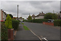
South Drive, Madeley
Local authority built housing to the south west of Madeley town centre.
Image: © Stephen McKay
Taken: 10 Oct 2015
0.09 miles
2
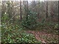
Woodland, Madeley
No sign, other than a bit of flattened ground, of the mapped reservoir which dates back to when Madeley had its own council. This is the spoil heap of Meadowpit Colliery
Image: © Richard Webb
Taken: 8 Dec 2021
0.15 miles
3
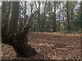
Woodland, Madeley
The now wooded spoil heap of Meadowpit Colliery
Image: © Richard Webb
Taken: 8 Dec 2021
0.16 miles
4
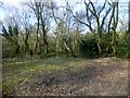
Madeley
Parked near bungalows to west and found track to summit area. A local that I met told me that it was formed from the spoil of a local mine workings.
Name: Madeley
Hill number: 17194
Height: 162m / 531ft
Parent (Ma/M): 2843 The Wrekin
Section: 38A: Shropshire
County/UA: Telford and Wrekin (UA)
Class: Tump (100-199m)
Grid ref: SJ 68872 04109
Summit feature: knoll in clearing
Drop: 49m
Col: 113m SJ688052
Image: © Rude Health
Taken: 25 Mar 2015
0.17 miles
5
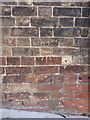
OS benchmark - Madeley, 87 Park Street
An OS cutmark on what is now known as Andy's Fish Bar in Madeley; originally levelled at 135.755m above Ordnance Datum Newlyn.
Image: © Richard Law
Taken: 19 Sep 2015
0.20 miles
6
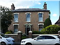
28 Park Street, Madeley
Dating from the first half of the 19th century, 28 Park Street was Grade II listed https://britishlistedbuildings.co.uk/101292962-28-park-street-madeley#.XOq1mIhKjcs & https://historicengland.org.uk/listing/the-list/list-entry/1292962 in 1983.
Image: © Richard Law
Taken: 11 May 2019
0.20 miles
7
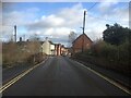
Ironbridge Road, Madeley
There is an undeveloped site on the left which was once a filling station. The whit building which appears to have been a shop is now a tatooists.
Image: © Richard Webb
Taken: 8 Dec 2021
0.20 miles
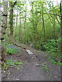
9
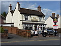
The Red Lion, Madeley
Banks' pub on Park Street, Madeley
Image: © Richard Law
Taken: 15 May 2010
0.21 miles
10
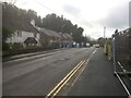
Ironbridge Road, Madeley
The Heras fencing is on the site of a demolished garage/filling station.
Image: © Richard Webb
Taken: 8 Dec 2021
0.21 miles