
IMAGES TAKEN NEAR TO
Bridgnorth Road, TELFORD, TF7 4JF
Introduction
This page details the photographs taken nearby to Bridgnorth Road, TF7 4JF by members of the Geograph project.
The Geograph project started in 2005 with the aim of publishing, organising and preserving representative images for every square kilometre of Great Britain, Ireland and the Isle of Man.

There are currently over 7.5m images from over14,400 individuals and you can help contribute to the project by visiting https://www.geograph.org.uk
Image Map
Images are licensed for reuse under creativecommons.org/licenses/by-sa/2.0
Notes
- Clicking on the map will re-center to the selected point.
- The higher the marker number, the further away the image location is from the centre of the postcode.
Image Listing (10 Images Found)
Images are licensed for reuse under creativecommons.org/licenses/by-sa/2.0
Image
Details
Distance
1
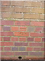
OS benchmark - Sutton Hill, 98 Stebbings
An OS cutmark on a wall at the side of a narrow path between houses on Sutton Hill; originally levelled at 117.796m above Ordnance Datum Newlyn.
Image: © Richard Law
Taken: 15 Nov 2015
0.14 miles
4
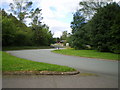
Brockton roundabout, and the road to Sutton Hill
Image: © Richard Law
Taken: 29 Aug 2009
0.17 miles
5
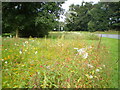
Wildflowers on Brockton roundabout
It's the modern fashion to plant swathes of colourful wildflowers on traffic islands at the moment; Telford & Wrekin Council are not immune.
Image: © Richard Law
Taken: 29 Aug 2009
0.21 miles
6
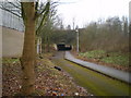
Underpass below the A442 Eastern Primary
A pedestrian/cycleway shared route, making for access from the northern side of Sutton Hill estate onto Halesfield 17.
Image: © Richard Law
Taken: 6 Feb 2010
0.22 miles
7
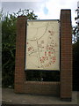
"You are here"
It's a fair bet we can place this picture (reasonably) accurately, as the little arrow beside the roundabout at the bottom of the map tells us where we are. How thoughtful.
Image: © Richard Law
Taken: 29 Aug 2009
0.22 miles
10
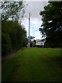
Mobile phone mast at Brockton roundabout
This presumably provides coverage for parts of Halesfield and Sutton Hill.
Image: © Richard Law
Taken: 29 Aug 2009
0.24 miles