
IMAGES TAKEN NEAR TO
Southgate, TELFORD, TF7 4HH
Introduction
This page details the photographs taken nearby to Southgate, TF7 4HH by members of the Geograph project.
The Geograph project started in 2005 with the aim of publishing, organising and preserving representative images for every square kilometre of Great Britain, Ireland and the Isle of Man.

There are currently over 7.5m images from over14,400 individuals and you can help contribute to the project by visiting https://www.geograph.org.uk
Image Map
Images are licensed for reuse under creativecommons.org/licenses/by-sa/2.0
Notes
- Clicking on the map will re-center to the selected point.
- The higher the marker number, the further away the image location is from the centre of the postcode.
Image Listing (24 Images Found)
Images are licensed for reuse under creativecommons.org/licenses/by-sa/2.0
Image
Details
Distance
1
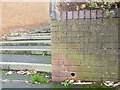
OS benchmark - Sutton Hill, steps to Sutton Way
An OS cutmark on a garden wall adjacent to a set of steps; originally levelled at 110.737m above Ordnance Datum Newlyn.
Image: © Richard Law
Taken: 15 Nov 2015
0.03 miles
2
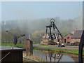
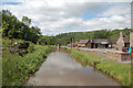
Blists Hill
End of canal, and (dummy) pithead gear.
Image: © John Hall
Taken: 2 Apr 2005
0.07 miles
5
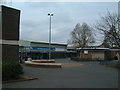
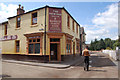
Central Sutton Hill
In the middle of a large council housing estate is this riviera... Sutton Hill Supermarket.
Image: © Steve McShane
Taken: 15 Apr 2006
0.11 miles
7
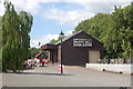
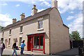
Blists Hill Goods station
This is just inside the entrance to Blists Hill Victorian Village
Image: © John Firth
Taken: 15 Jun 2010
0.15 miles
8
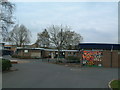
Sutton Hill Church
They come in all shapes and sizes...
This church is a Church Of England church in the centre of Sutton Hill.
Image: © Steve McShane
Taken: 15 Apr 2006
0.16 miles
9
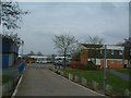
One Big Council Estate
Which sums Sutton Hill up. This view of Stonedale, taken from near the Sir Alexander Fleming school, gives an indication for the rest of Sutton Hill - council housing from the 60s...
Image: © Steve McShane
Taken: 15 Apr 2006
0.16 miles
10
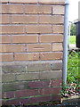
OS benchmark - Sutton Hill, 124 Summerhill
An OS cutmark on the wall of house no 124; originally levelled at 105.851m above Ordnance Datum Newlyn.
Image: © Richard Law
Taken: 15 Nov 2015
0.16 miles