
IMAGES TAKEN NEAR TO
Queen Street, TELFORD, TF7 4BW
Introduction
This page details the photographs taken nearby to Queen Street, TF7 4BW by members of the Geograph project.
The Geograph project started in 2005 with the aim of publishing, organising and preserving representative images for every square kilometre of Great Britain, Ireland and the Isle of Man.

There are currently over 7.5m images from over14,400 individuals and you can help contribute to the project by visiting https://www.geograph.org.uk
Image Map
Images are licensed for reuse under creativecommons.org/licenses/by-sa/2.0
Notes
- Clicking on the map will re-center to the selected point.
- The higher the marker number, the further away the image location is from the centre of the postcode.
Image Listing (18 Images Found)
Images are licensed for reuse under creativecommons.org/licenses/by-sa/2.0
Image
Details
Distance
1
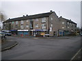
Parade of shops in Madeley
On the corner of Hills Lane Drive
Image: © Richard Law
Taken: 6 Feb 2010
0.05 miles
3
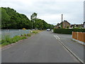
Kemberton Road, Madeley
Housing on the eastern side of Madeley, along Kemberton Road. The main route to Bridgnorth lies just a few metres to the left, beside the trees.
Image: © Richard Law
Taken: 4 Jun 2020
0.11 miles
5
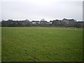
Playing fields near Madeley
A field behind the Haughton School grounds, set out as a football pitch.
Image: © Richard Law
Taken: 6 Feb 2010
0.14 miles
6
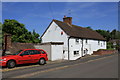
Old Toll House, Madeley
Toll House in the parish of Madeley at the junction of Hills Lane and Queen Street.
Surveyed
Milestone Society National ID: SA.MAD01
Image: © Milestone Society
Taken: Unknown
0.14 miles
7
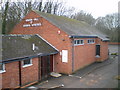
The Kingdom Hall of Jehovahs' Witnesses, Madeley
This hall was demolished in late 2011, and a new Kingdom Hall has now been erected.
Image: © Richard Law
Taken: 6 Feb 2010
0.16 miles
9
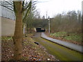
Underpass below the A442 Eastern Primary
A pedestrian/cycleway shared route, making for access from the northern side of Sutton Hill estate onto Halesfield 17.
Image: © Richard Law
Taken: 6 Feb 2010
0.17 miles
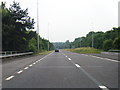
10
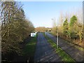
A4169
Serves the industrial estates at Halesfield.
Image: © Richard Webb
Taken: 16 Feb 2014
0.17 miles