
IMAGES TAKEN NEAR TO
Preston, TELFORD, TF6 6DH
Introduction
This page details the photographs taken nearby to TF6 6DH by members of the Geograph project.
The Geograph project started in 2005 with the aim of publishing, organising and preserving representative images for every square kilometre of Great Britain, Ireland and the Isle of Man.

There are currently over 7.5m images from over14,400 individuals and you can help contribute to the project by visiting https://www.geograph.org.uk
Image Map
Images are licensed for reuse under creativecommons.org/licenses/by-sa/2.0
Notes
- Clicking on the map will re-center to the selected point.
- The higher the marker number, the further away the image location is from the centre of the postcode.
Image Listing (17 Images Found)
Images are licensed for reuse under creativecommons.org/licenses/by-sa/2.0
Image
Details
Distance
3
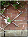
OS benchmark - Preston, St Lawrence's church
An OS cutmark at the base of the church tower; originally levelled at 66.706 above Ordnance Datum Newlyn.
Image: © Richard Law
Taken: 17 May 2015
0.07 miles
4
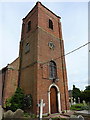
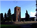
St Lawrence's church tower
The tower stands high above the graveyard and a small, well-kept village green.
Image: © Richard Law
Taken: 16 Jun 2013
0.07 miles
5
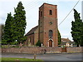
St Lawrence's Church, Preston on the Weald Moors
And a Geographer's bike, leant up against the church wall.
Image: © Richard Law
Taken: 16 Jun 2013
0.07 miles
7
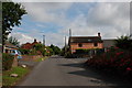
Road and Red Brick House, Preston upon the Weald Moors
Image: © Mick Malpass
Taken: 11 Jul 2011
0.08 miles
8

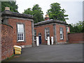
Preston upon the Weald Moors
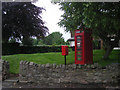
A telephone box and a post box are situated in someone's front garden!
Image: © A Holmes
Taken: 29 Apr 2007
0.10 miles
10

Preston Bridge, Shrewsbury and Newport Canal, Shropshire
When this photograph was taken in 1964, the canal, although disused, was still in water. The remains of a lock-gate can be seen. The bridge carried the metalled lane from Preston upon the Weald Moors to Kynnersley. A society now exists with the aim of restoring the canal here.
Image: © Dr Neil Clifton
Taken: 11 Apr 1964
0.18 miles