IMAGES TAKEN NEAR TO
Meadow View, TELFORD, TF6 5HP
Introduction
This page details the photographs taken nearby to Meadow View, TF6 5HP by members of the Geograph project.
The Geograph project started in 2005 with the aim of publishing, organising and preserving representative images for every square kilometre of Great Britain, Ireland and the Isle of Man.

There are currently over 7.5m images from over14,400 individuals and you can help contribute to the project by visiting https://www.geograph.org.uk
Image Map
Images are licensed for reuse under creativecommons.org/licenses/by-sa/2.0
Notes
- Clicking on the map will re-center to the selected point.
- The higher the marker number, the further away the image location is from the centre of the postcode.
Image Listing (7 Images Found)
Images are licensed for reuse under creativecommons.org/licenses/by-sa/2.0
Image
Details
Distance
2
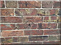
OS benchmark - Uppington, The Smithy
An OS cutmark on the wall of a (former) smithy building beside the road to Bluebell crossroads; it was last levelled by the OS in 1966 at 101.322m above Ordnance Datum Newlyn, but is recorded on older maps at 322.5ft above Liverpool datum.
Image: © Richard Law
Taken: 4 Sep 2022
0.05 miles
4
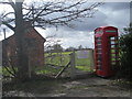
Uppington ATE & phone kiosk (a K6 I think)
The parlance may be a little out of date but any older members of BT will know what I mean.
Image: © Row17
Taken: 21 Mar 2008
0.12 miles
5
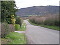
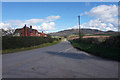
Lane out of Uppington
The Wrekin looms large in the background.
Image: © Row17
Taken: 21 Mar 2008
0.12 miles
6
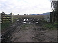
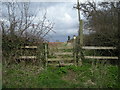
Muddy Path to Aston
In this muddy field corner is a footpath the leads to nearby Aston.
Image: © Michael Patterson
Taken: 24 Jan 2007
0.20 miles