
IMAGES TAKEN NEAR TO
Station Road, TELFORD, TF4 2NL
Introduction
This page details the photographs taken nearby to Station Road, TF4 2NL by members of the Geograph project.
The Geograph project started in 2005 with the aim of publishing, organising and preserving representative images for every square kilometre of Great Britain, Ireland and the Isle of Man.

There are currently over 7.5m images from over14,400 individuals and you can help contribute to the project by visiting https://www.geograph.org.uk
Image Map
Images are licensed for reuse under creativecommons.org/licenses/by-sa/2.0
Notes
- Clicking on the map will re-center to the selected point.
- The higher the marker number, the further away the image location is from the centre of the postcode.
Image Listing (37 Images Found)
Images are licensed for reuse under creativecommons.org/licenses/by-sa/2.0
Image
Details
Distance
1
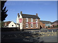
The Royal Exchange, Dawley
Still waiting for real beer.
Now closed and has become a private dwelling (Summer 2009)
Image: © al partington
Taken: 11 Jul 2006
0.11 miles
2
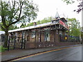
The former Dawley National School
Now forming part of the Dawley C of E Primary School complex, the older building here with the scaffolding bears a blue plaque proclaiming that it was originally the local National School.
Image: © Richard Law
Taken: 9 May 2023
0.12 miles
3
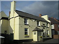
The Station Inn
It's in the 'Good Beer Guide'.
Image: © Row17
Taken: 27 Feb 2008
0.12 miles


6
Doseley Road, Dawley
One of several older roads radiating out from the historic centre of Dawley, which were cut in two by the construction of the B4373 southern bypass of the town.
Image: © Richard Law
Taken: 9 May 2023
0.15 miles
9
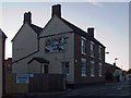
The Royal Exchange, Dawley
Closed as a pub; now a private residence. See it as a pub: Image
Image: © Mike White
Taken: 29 Mar 2009
0.16 miles
10
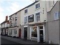
11, 11a & 15 Burton Street, Dawley
The numbering arrangement here seems a bit strange (what happened to no 13?) but leaving that aside, these three shops date from the early 19th century, and were collectively Grade II listed https://britishlistedbuildings.co.uk/101367384-11-11a-and-15-burton-street-great-dawley#.X2fAoWhKjIU & https://historicengland.org.uk/listing/the-list/list-entry/1367384 in 1983. The listing describes them as "a good group of joined address units with early C19 shop fronts"
Image: © Richard Law
Taken: 12 Sep 2020
0.17 miles