
IMAGES TAKEN NEAR TO
Field Close, TELFORD, TF4 2EH
Introduction
This page details the photographs taken nearby to Field Close, TF4 2EH by members of the Geograph project.
The Geograph project started in 2005 with the aim of publishing, organising and preserving representative images for every square kilometre of Great Britain, Ireland and the Isle of Man.

There are currently over 7.5m images from over14,400 individuals and you can help contribute to the project by visiting https://www.geograph.org.uk
Image Map
Images are licensed for reuse under creativecommons.org/licenses/by-sa/2.0
Notes
- Clicking on the map will re-center to the selected point.
- The higher the marker number, the further away the image location is from the centre of the postcode.
Image Listing (16 Images Found)
Images are licensed for reuse under creativecommons.org/licenses/by-sa/2.0
Image
Details
Distance
2
Houses on Prince Edward Crescent, Malinslee
Image: © Richard Law
Taken: 25 Nov 2022
0.12 miles
3
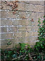
OS benchmark - Malinslee, Royal Way
An OS cutmark on the garden wall of a house backing onto Royal Way; originally levelled in 1984 at 194.451m above Ordnance Datum Newlyn.
Image: © Richard Law
Taken: 14 Sep 2014
0.12 miles
4

Houses on St Christopher's Way, Malinslee
Image: © Richard Law
Taken: 23 Mar 2026
0.13 miles
5
View down Royal Way, Malinslee
The opposing view is in Image
Image: © Richard Law
Taken: 25 Nov 2022
0.17 miles
6
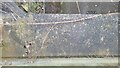
Malinslee Subway Parapet Rivet Benchmark
The Ordnance Survey Rivet Benchmark set into the parapet of a subway in Malinslee, Telford. The accompanying Crow's Foot is faded but still visible. The Third Order Rivet was levelled and verified by the OS in 1984. The records report the height AODN as 201.899-metres
Image: © Anthony Rowley
Taken: 12 Mar 2022
0.18 miles
7
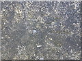
OS rivet - Lawley bank, subway wall
An OS rivet-style benchmark on the wall of the subway beneath the B4373; originally levelled in 1984 at 201.899m above Ordnance Datum Newlyn.
Image: © Richard Law
Taken: 14 Sep 2014
0.19 miles
8
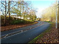
Looking up Royal Way, Malinslee
Pretty much the opposite view to that seen in Image
Image: © Richard Law
Taken: 25 Nov 2022
0.19 miles
9
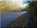
Junction of Royal Way and Brunel Road, Malinslee
Image: © Richard Law
Taken: 25 Nov 2022
0.19 miles
10

Bungalows on Edward Parry Court in Dawley Bank
This part of the estate has the look of sheltered accommodation.
Image: © Richard Law
Taken: 23 Mar 2026
0.20 miles