
IMAGES TAKEN NEAR TO
Sunny Lane, TELFORD, TF3 5GB
Introduction
This page details the photographs taken nearby to Sunny Lane, TF3 5GB by members of the Geograph project.
The Geograph project started in 2005 with the aim of publishing, organising and preserving representative images for every square kilometre of Great Britain, Ireland and the Isle of Man.

There are currently over 7.5m images from over14,400 individuals and you can help contribute to the project by visiting https://www.geograph.org.uk
Image Map
Images are licensed for reuse under creativecommons.org/licenses/by-sa/2.0
Notes
- Clicking on the map will re-center to the selected point.
- The higher the marker number, the further away the image location is from the centre of the postcode.
Image Listing (28 Images Found)
Images are licensed for reuse under creativecommons.org/licenses/by-sa/2.0
Image
Details
Distance
1
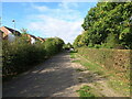
Footpath through the Newdale housing development
A public footpath, whose existence predates the huge Newdale/Lawley housing developments in this area.
Image: © Richard Law
Taken: 17 Sep 2022
0.08 miles
2
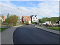
Fence repairs on Birchfield Way
A couple of workmen repairing fencing beside the path that crosses Birchfield Way.
Image: © Richard Law
Taken: 17 Sep 2022
0.09 miles
3
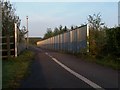
Wrekin Way bridge
The bridleway passes over the A5223 here.
Image: © Mike White
Taken: 18 Apr 2009
0.10 miles
4
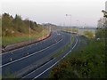
Cones on the A5223
The coned road winds on its way to junctions with the M54.
Image: © Mike White
Taken: 18 Apr 2009
0.12 miles
5
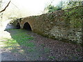
The Newdale tramway bridge
Built around 1759 to carry a plate railway/tramway from Coalbrookdale to Donnington Wood, and now one of the very few remnants of the once-extensive network of tramways across the area. It was Grade II listed https://britishlistedbuildings.co.uk/101025096-newdale-tramway-bridge-lawley-and-overdale#.YJHJ9rVKjIU & https://historicengland.org.uk/listing/the-list/list-entry/1025096 in 1983.
Image: © Richard Law
Taken: 2 Apr 2021
0.12 miles
6
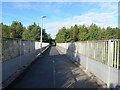
Footbridge over the B5223 Lawley Drive
This is the same bridge as Image, but taken 13 years later. Little has changed apart from replacement heads in the streetlamps.
Image: © Richard Law
Taken: 17 Sep 2022
0.12 miles
7
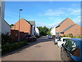
West along Cheshires Way, Lawley
Part of the extensive Lawley & Newdale housing development.
Image: © Richard Law
Taken: 17 Sep 2022
0.13 miles
8
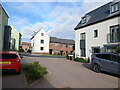
Houses on Reynolds Fold
Part of the huge Lawley Furnaces/Newdale housing development to the west of Telford.
Image: © Richard Law
Taken: 17 Sep 2022
0.13 miles
9
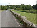
Shared-use path by Newdale Pond
The stones on the side of the path here appear to have been previously shaped into large, roughly blocks. It's hard to tell where they came from, but I suspect they are left over from a previous industrial site in the area, which is known as Lawley Furnaces. There was extensive coal (and some iron ore) mining nearby in the 18th & 19th centuries, and the old Image lies not far away, so they may have been part of the trackway for that.
Image: © Richard Law
Taken: 20 Sep 2022
0.14 miles
10
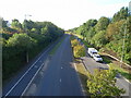
Looking south along Lawley Drive
Pretty much the same stretch of road as Image, but this time looking south into a bright morning sun.
Image: © Richard Law
Taken: 17 Sep 2022
0.15 miles