IMAGES TAKEN NEAR TO
Norwich Drive, TELFORD, TF3 2NS
Introduction
This page details the photographs taken nearby to Norwich Drive, TF3 2NS by members of the Geograph project.
The Geograph project started in 2005 with the aim of publishing, organising and preserving representative images for every square kilometre of Great Britain, Ireland and the Isle of Man.

There are currently over 7.5m images from over14,400 individuals and you can help contribute to the project by visiting https://www.geograph.org.uk
Image Map
Images are licensed for reuse under creativecommons.org/licenses/by-sa/2.0
Notes
- Clicking on the map will re-center to the selected point.
- The higher the marker number, the further away the image location is from the centre of the postcode.
Image Listing (13 Images Found)
Images are licensed for reuse under creativecommons.org/licenses/by-sa/2.0
Image
Details
Distance
1
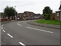
Abbey Field, Randlay
Abbey Field, Randlay in the Stirchley area of Telford.
Image: © Philip Halling
Taken: 28 Aug 2018
0.06 miles
2
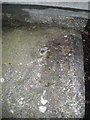
OS benchmark & rivet - Stirchley Avenue subway
An OS rivet and benchmark arrow on the parapet of the subway bridge under Stirchley Avenue; originally levelled at 124.532m above Ordnance Datum Newlyn.
Image: © Richard Law
Taken: 14 Feb 2015
0.13 miles
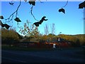
3
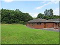
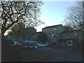
Boscobel Tavern
Pub off Stirchley Avenue.
Image: © Richard Webb
Taken: 30 Jun 2014
0.16 miles
4
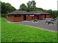
Boscobel Tavern
Boscobel Tavern near Stirchley.
Image: © Philip Halling
Taken: 28 Aug 2018
0.16 miles
5
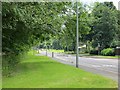
Stirchley Avenue
A new town distribution road.
Image: © Richard Webb
Taken: 30 Jun 2014
0.17 miles
6
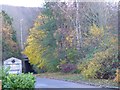
Nedge Lane, Telford
Leading under the A442 towards Nedge Farm.
Image: © Steve Barnes
Taken: 10 Nov 2012
0.19 miles
7
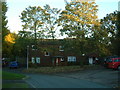
The Nedge
Nedge Hill social club, a local club for booze and entertainment.
Image: © Steve McShane
Taken: 12 Nov 2005
0.19 miles
8
Eliot Close
The road now turns into the close - formerly went straight down to the left and under the Eastern Primary towards Nedge Hill. Here is new housing - this used to be open land where a cub scout hut used to be.
Image: © Steve McShane
Taken: 12 Nov 2005
0.19 miles
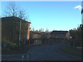
9
Boulton Grange
Leafy area of one of Randlay's old council estates.
Image: © Steve McShane
Taken: 12 Nov 2005
0.21 miles
10
Boulton Grange 2
Further housing, slightly different style.
Image: © Steve McShane
Taken: 12 Nov 2005
0.21 miles