IMAGES TAKEN NEAR TO
Waggoners Fold, TELFORD, TF3 2HL
Introduction
This page details the photographs taken nearby to Waggoners Fold, TF3 2HL by members of the Geograph project.
The Geograph project started in 2005 with the aim of publishing, organising and preserving representative images for every square kilometre of Great Britain, Ireland and the Isle of Man.

There are currently over 7.5m images from over14,400 individuals and you can help contribute to the project by visiting https://www.geograph.org.uk
Image Map
Images are licensed for reuse under creativecommons.org/licenses/by-sa/2.0
Notes
- Clicking on the map will re-center to the selected point.
- The higher the marker number, the further away the image location is from the centre of the postcode.
Image Listing (14 Images Found)
Images are licensed for reuse under creativecommons.org/licenses/by-sa/2.0
Image
Details
Distance
1

West along Brunel Road in Malinslee
Brunel Road is the main distributor and through-road for the Malinslee housing estate.
Image: © Richard Law
Taken: 1 Oct 2025
0.05 miles
2

Houses and carparking in a cul-de-sac of Farm Lodge Grove
Houses in the extensive Malinslee estate, built probably in the mid or late 1970s
Image: © Richard Law
Taken: 1 Oct 2025
0.06 miles

4

Houses on Farm Lodge Grove
Part of the extensive Malinslee estate in Telford.
Image: © Richard Law
Taken: 1 Oct 2025
0.11 miles
5

Houses and carparking on Lawnswood
Part of the extensive Malinslee housing estate in Telford.
Image: © Richard Law
Taken: 1 Oct 2025
0.13 miles
6
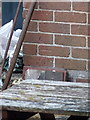
OS benchmark - Dawley, 28 Mount Road
An OS cutmark in the front wall of no 28 Mount Road; originally levelled in 1961 at 184.797m abov Ordnance Datum Newlyn.
Image: © Richard Law
Taken: 3 Oct 2014
0.17 miles
7

Intersection of paths just east of Malinslee estate
Image: © Richard Law
Taken: 1 Oct 2025
0.19 miles
8

Houses at the end of Withywood Drive, Malinslee
Part of the extensive Malinslee housing estate. In this shot, the trees at the back occupy the site of the spoil heap from the Spout Colliery, which has now mostly been incorporated into the Telford Town Park. The colliery was disused by 1901, probably in the 1890s.
Image: © Richard Law
Taken: 1 Oct 2025
0.21 miles