
IMAGES TAKEN NEAR TO
Churchway, TELFORD, TF3 1XB
Introduction
This page details the photographs taken nearby to Churchway, TF3 1XB by members of the Geograph project.
The Geograph project started in 2005 with the aim of publishing, organising and preserving representative images for every square kilometre of Great Britain, Ireland and the Isle of Man.

There are currently over 7.5m images from over14,400 individuals and you can help contribute to the project by visiting https://www.geograph.org.uk
Image Map
Images are licensed for reuse under creativecommons.org/licenses/by-sa/2.0
Notes
- Clicking on the map will re-center to the selected point.
- The higher the marker number, the further away the image location is from the centre of the postcode.
Image Listing (9 Images Found)
Images are licensed for reuse under creativecommons.org/licenses/by-sa/2.0
Image
Details
Distance
1
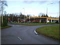
Shell filling station, Stirchley roundabout
Image: © Richard Law
Taken: 5 Dec 2009
0.06 miles
3
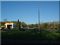
Stirchley Roundabout
A big roundabout in Telford. Well, there's plenty of them in Telford. This one has a Shell garage and exits towards Stirchley, Halesfield and Brookside.
Image: © Steve McShane
Taken: 12 Nov 2005
0.13 miles
4
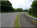
Exit from Stirchley roundabout onto Halesfield 1
Normally quite a busy road and roundabout. I caught it at a quiet time, as England were busy losing 1-0 to Spain in the Euro 2024 football tournament final, and many people were preoccupied with that.
Image: © Richard Law
Taken: 14 Jul 2024
0.14 miles
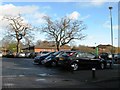
6
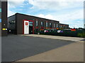
Grange Park Primary school, Stirchley
Located just adjacent to Image, and presumably a 'feeder' school for that establishment.
Image: © Richard Law
Taken: 5 Jun 2021
0.23 miles
7
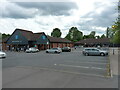
Co-op supermarket, Stirchley
The Co-op occupies the nearest building, with a couple of takeaway businesses and the like in the unit at the far side of the carpark.
Image: © Richard Law
Taken: 5 Jun 2021
0.25 miles
8
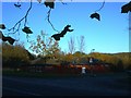
The Nedge
Nedge Hill social club, a local club for booze and entertainment.
Image: © Steve McShane
Taken: 12 Nov 2005
0.25 miles
9
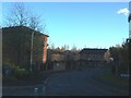
Eliot Close
The road now turns into the close - formerly went straight down to the left and under the Eastern Primary towards Nedge Hill. Here is new housing - this used to be open land where a cub scout hut used to be.
Image: © Steve McShane
Taken: 12 Nov 2005
0.25 miles