
IMAGES TAKEN NEAR TO
Edith Close, TELFORD, TF3 1AX
Introduction
This page details the photographs taken nearby to Edith Close, TF3 1AX by members of the Geograph project.
The Geograph project started in 2005 with the aim of publishing, organising and preserving representative images for every square kilometre of Great Britain, Ireland and the Isle of Man.

There are currently over 7.5m images from over14,400 individuals and you can help contribute to the project by visiting https://www.geograph.org.uk
Image Map
Images are licensed for reuse under creativecommons.org/licenses/by-sa/2.0
Notes
- Clicking on the map will re-center to the selected point.
- The higher the marker number, the further away the image location is from the centre of the postcode.
Image Listing (13 Images Found)
Images are licensed for reuse under creativecommons.org/licenses/by-sa/2.0
Image
Details
Distance
1

Looking north along the Silkin Way
The Silkin Way is a 13-mile through-route connecting north to south Telford; at this stage, it follows the route of the former Coalport Branch of the London & Northwest Railway.
Image: © Richard Law
Taken: 26 Sep 2025
0.04 miles
2
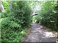
Wellington and Coalport Branch
A path through wooded former industrial land.
Image: © Richard Webb
Taken: 30 Jun 2014
0.06 miles
3

Silkin Way bridge under Southall Road
Interestingly, this bridge is a later addition to the former railway line, as it wasn't here in the 1800s. Appears to have been built sometime after 1921. It is not marked on historical Ordnance Survey maps (i.e. OS Six Inch, 1888-1915).
Image: © TCExplorer
Taken: 22 Jul 2026
0.08 miles
4

The Silkin Way cycle path near Stirchley
Image: © TCExplorer
Taken: 22 Jul 2026
0.14 miles
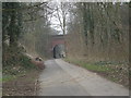
6

Welcome sign to Telford Town Park
In my opinion, this is quite far out to be welcoming people to the "park"...
See also Image from 2023.
Image: © TCExplorer
Taken: 22 Jul 2026
0.16 miles
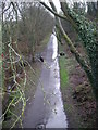
8
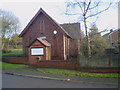
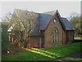
Scout Group hall, Aqueduct
The headquarters of Brookside Scout group, in a converted chapel dating from 1851.
Image: © Richard Law
Taken: 5 Dec 2009
0.18 miles
10
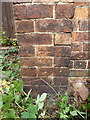
OS benchmark - Aqueduct, Methodist Hall
An OS cutmark on the south-facing wall of a small methodist chapel/hall on Aqueduct Road; originally levelled at 127.538m above Ordnance Datum Newlyn.
Image: © Richard Law
Taken: 15 Aug 2015
0.18 miles