
IMAGES TAKEN NEAR TO
Calder Close, TELFORD, TF2 8SW
Introduction
This page details the photographs taken nearby to Calder Close, TF2 8SW by members of the Geograph project.
The Geograph project started in 2005 with the aim of publishing, organising and preserving representative images for every square kilometre of Great Britain, Ireland and the Isle of Man.

There are currently over 7.5m images from over14,400 individuals and you can help contribute to the project by visiting https://www.geograph.org.uk
Image Map
Images are licensed for reuse under creativecommons.org/licenses/by-sa/2.0
Notes
- Clicking on the map will re-center to the selected point.
- The higher the marker number, the further away the image location is from the centre of the postcode.
Image Listing (8 Images Found)
Images are licensed for reuse under creativecommons.org/licenses/by-sa/2.0
Image
Details
Distance
2
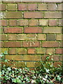
OS benchmark - Muxton Grange
A clear OS cutmark on a derelict mine building in the woods near the Granville Country Park; originally levelled at 97.542 above Ordnance Datum Newlyn.
Image: © Richard Law
Taken: 13 Sep 2014
0.15 miles
3
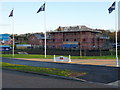
New-build housing at Muxton - Regent's Crescent
Image: © Richard Law
Taken: 9 Dec 2011
0.18 miles
4
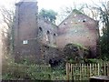
Former Pumping House
Remains of the coal industry in this area
Image: © John Sparshatt
Taken: 4 Dec 2012
0.24 miles
5
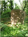
Remains of pumping engine structure
Technically, this is the remaining part of the bob wall of the pumping engine which drained the nearby Muxton Bridge Colliery for a period during its operation. This wall, along with a couple of adjacent flywheel pits and some remaining iron pipes and retaining bolts, plus a variety of sub-surface structures, were all designated as a Scheduled Monument https://historicengland.org.uk/listing/the-list/list-entry/1018468 in 1998.
Image: © Richard Law
Taken: 7 Jun 2020
0.24 miles
6
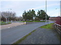
Donnington Wood roundabout
On the B5060, between Muxton and the main part of Donnington Wood.
Image: © Richard Law
Taken: 14 Jan 2017
0.24 miles
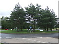
8
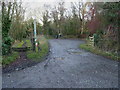
A small carpark and part of NCN Route 55
The carpark gives access to walks (and short rides) in the Granville Country Park, which if the truth be told, is a tad muddy at this time of year.
Image: © Richard Law
Taken: 9 Dec 2011
0.24 miles