OS benchmark - Muxton Grange
Introduction
The photograph on this page of OS benchmark - Muxton Grange by Richard Law as part of the Geograph project.
The Geograph project started in 2005 with the aim of publishing, organising and preserving representative images for every square kilometre of Great Britain, Ireland and the Isle of Man.

There are currently over 7.5m images from over 14,400 individuals and you can help contribute to the project by visiting https://www.geograph.org.uk
OS benchmark - Muxton Grange
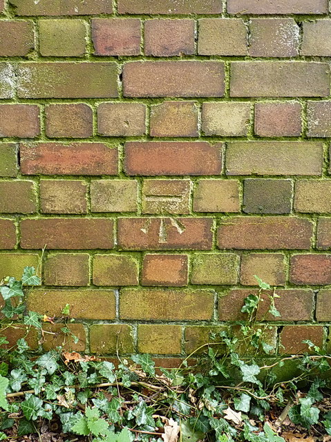
Image: © Richard Law Taken: 13 Sep 2014
A clear OS cutmark on a derelict mine building in the woods near the Granville Country Park; originally levelled at 97.542 above Ordnance Datum Newlyn.
Images are licensed for reuse under creativecommons.org/licenses/by-sa/2.0
Image Location
Latitude
52.716138
Longitude
-2.413819