
IMAGES TAKEN NEAR TO
Teagues Crescent, TELFORD, TF2 6RA
Introduction
This page details the photographs taken nearby to Teagues Crescent, TF2 6RA by members of the Geograph project.
The Geograph project started in 2005 with the aim of publishing, organising and preserving representative images for every square kilometre of Great Britain, Ireland and the Isle of Man.

There are currently over 7.5m images from over14,400 individuals and you can help contribute to the project by visiting https://www.geograph.org.uk
Image Map
Images are licensed for reuse under creativecommons.org/licenses/by-sa/2.0
Notes
- Clicking on the map will re-center to the selected point.
- The higher the marker number, the further away the image location is from the centre of the postcode.
Image Listing (15 Images Found)
Images are licensed for reuse under creativecommons.org/licenses/by-sa/2.0
Image
Details
Distance
1
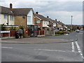
Teagues Crescent and Wombridge Road
The junction of the two roads, with post box TF2 61 in the wall pillar.
Image: © Richard Law
Taken: 12 Mar 2011
0.08 miles
2
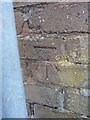
OS benchmark - Trench, Wombridge Road
An OS cutmark on the boundary wall of no 253, Wombridge Road; originally levelled at 92.708m above Ordnance Datum Newlyn.
Image: © Richard Law
Taken: 10 Aug 2014
0.13 miles
3
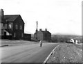
Teagues Bridge Lane, Trench
A lot of change has taken place here since this 1963 photograph. All the buildings in the foreground have gone, (also the old Bridge Inn which was just out of shot to the left) to be replaced by modern houses. And the road, which had just been widened here, is now called Wombridge Road. Note the complete absence of traffic.
Image: © Dr Neil Clifton
Taken: 23 Mar 1963
0.15 miles
4
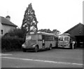
Eagle Coaches garage, Trench
This shows the small garage of Smith's Eagle Coaches, with one of their two Bedford OWBs and a luxurious Burlingham-bodied AEC Reliance coach. Apart from their coaching interests, the firm also participated in the local bus service between Wellington and Donnington, via Trench.
Image: © Dr Neil Clifton
Taken: 10 Aug 1966
0.20 miles
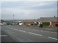
6
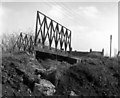
Teagues Bridge, Trench, Shropshire
This photograph shows the remains of one of the original bridges over the Shropshire High Level canal system that once existed in this area. The lane passing over the bridge was called Teagues Bridge Lane, but is now a motor road and renamed Wombridge Road in about 1965. The boats using this canal were tub boats, about 20ft x 6ft 3ins in dimension, and they worked in 'gangs' of four, carrying coal. Travelling west, the loaded boats would then work down the Trench inclined plane, at the foot of which the coal was trans-shipped into narrow boats. The area of this photograph is now completely built over with modern housing.
Image: © Dr Neil Clifton
Taken: 23 Mar 1963
0.20 miles
7
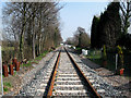
Relaid Railway Track, Trench Crossing
The rail line to the new Donnington freight depot has now been relaid and is due to come into full use again in late April or early May 2009. The track was lifted in 1999 when the link to the Army Depot at Donnington was declared redundant.
See the line in the early 60's shortly after the through line to Stafford was closed.Image
Image: © Gordon Cragg
Taken: 19 Mar 2009
0.22 miles
8
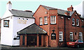
Trench Tavern
The Trench Tavern, Trench Road, Trench.
Image: © Gordon Cragg
Taken: Unknown
0.23 miles
9
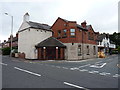
The former Trench Tavern
Now closed, and in the process of being converted to flats by the look of things.
Image: © Richard Law
Taken: 16 Jul 2016
0.23 miles
10
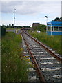
The line into the Telford Railfreight Terminal
The terminal was opened in 2009, after a 7 or 8 year gestation period, and aimed to provide railfreight handling facilities for the industrial businesses of Telford, and the nearby (MOD-operated) Defence Storage and Distribution Agency. However, maybe it's not been very busy recently, as there's now a cat sitting on the line...
Image: © Richard Law
Taken: 1 Jul 2012
0.23 miles