IMAGES TAKEN NEAR TO
Sandpiper Close, TELFORD, TF1 6WH
Introduction
This page details the photographs taken nearby to Sandpiper Close, TF1 6WH by members of the Geograph project.
The Geograph project started in 2005 with the aim of publishing, organising and preserving representative images for every square kilometre of Great Britain, Ireland and the Isle of Man.

There are currently over 7.5m images from over14,400 individuals and you can help contribute to the project by visiting https://www.geograph.org.uk
Image Map
Images are licensed for reuse under creativecommons.org/licenses/by-sa/2.0
Notes
- Clicking on the map will re-center to the selected point.
- The higher the marker number, the further away the image location is from the centre of the postcode.
Image Listing (15 Images Found)
Images are licensed for reuse under creativecommons.org/licenses/by-sa/2.0
Image
Details
Distance
1

Grainger Drive Subway Parapet Benchmark
The Ordnance Survey Rivet Benchmark set into the parapet of a subway on Grainger Drive, Leegomery, Telford. It was both levelled and (last) verified by the OS in 1984. The recorded AODN is 79.61-metres
Image: © Anthony Rowley
Taken: 18 Mar 2022
0.05 miles
2
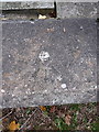
OS rivet - Leegomery, Grainger Drive underpass
An OS rivet & arrowmark on the parapet of a (now-infilled) underpass on Grainger Drive; originally emplaced in 1984 at 79.61m above Ordnance Datum Newlyn.
Image: © Richard Law
Taken: 18 Oct 2015
0.05 miles
3
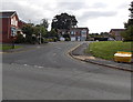
Kingfisher Way, Apley, Wellington
Viewed across Grainger Drive.
Image: © Jaggery
Taken: 10 Oct 2013
0.06 miles
4

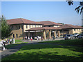
The Apley Clinic, Princess Royal Hospital, Telford
The clinic stands back a little.
Image: © Jeremy Bolwell
Taken: 24 Jul 2016
0.08 miles
5
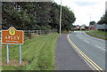
Western boundary of Apley, Wellington
The boundary sign alongside Grainger Drive shows that Apley is part of Hadley and Leegomery Parish.
Image: © Jaggery
Taken: 10 Oct 2013
0.14 miles
6
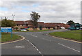
South side of the Princess Royal Hospital in Wellington
Viewed from the entrance road from the Apley Roundabout. On the right, an Arriva bus is at a bus stop.
Image: © Jaggery
Taken: 10 Oct 2013
0.15 miles
7
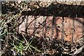
Princess Royal Hospital Culvert Benchmark
The Ordnance Survey Rivet Benchmark set into the drainage culvert adjacent to the Princess Royal Hospital in Telford. It is 3-metres from the footpath. Grid Reference SJ 65516 12674. The recorded AODN is 85.74-metres. It was levelled and verified by the OS in 1984.
Image: © Anthony Rowley
Taken: 18 Mar 2022
0.15 miles
8

Car parking at part of the Princess Royal Hospital, Telford
Nice bit of hospital scenery.
Image: © Jeremy Bolwell
Taken: 24 Jul 2016
0.17 miles
9
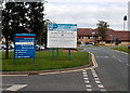
Welcome to the Princess Royal Hospital in Wellington
The welcome sign is alongside the entrance road from the Apley Roundabout.
Image: © Jaggery
Taken: 10 Oct 2013
0.17 miles