
IMAGES TAKEN NEAR TO
Parkdale, TELFORD, TF1 6PF
Introduction
This page details the photographs taken nearby to Parkdale, TF1 6PF by members of the Geograph project.
The Geograph project started in 2005 with the aim of publishing, organising and preserving representative images for every square kilometre of Great Britain, Ireland and the Isle of Man.

There are currently over 7.5m images from over14,400 individuals and you can help contribute to the project by visiting https://www.geograph.org.uk
Image Map
Images are licensed for reuse under creativecommons.org/licenses/by-sa/2.0
Notes
- Clicking on the map will re-center to the selected point.
- The higher the marker number, the further away the image location is from the centre of the postcode.
Image Listing (27 Images Found)
Images are licensed for reuse under creativecommons.org/licenses/by-sa/2.0
Image
Details
Distance
1
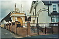
Hadley Sikh Temple
This building is part of what used to be the old Hadley Junior school
Image: © Carol Walker
Taken: Unknown
0.08 miles
2
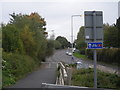
NCR 81 at Britannia Way, Hadley, Telford
The map gives the impression that the NCR goes over a disused railway line. May I point out that the railway line is far from disused - it links the MOD property a couple of miles away with the main network near Wellington.
Image: © Row17
Taken: 6 Oct 2008
0.10 miles
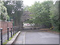
4
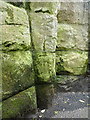
OS benchmark - Hadley, railway bridge on Hadley Park Road
It's barely visible on the weathered sandstone, and in a rather dank corner of the old railway bridge, but there is an OS cutmark in the middle of the shot, which was originally levelled in 1961 at 82.24m above Ordnance Datum Newlyn.
Image: © Richard Law
Taken: 16 Jul 2016
0.12 miles
5
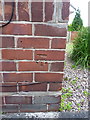
OS benchmark - Hadley, 26 Hadley Park Road
An OS cutmark on the side wall of 26 Hadley Park Road; originally levelled in 1961 at 80.31m above Ordnance Datum Newlyn.
Image: © Richard Law
Taken: 16 Jul 2016
0.12 miles
6
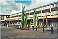
Hadley Shopping Precinct 2008
The only word to describe it is 'retro'! It has a handy little outside market and the Post Office does a roaring trade.
Image: © Carol Walker
Taken: Unknown
0.13 miles
7
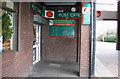
Entrance to Post Office, Hadley, Telford
The entrance to the Post Office in the corner of the Hadley Shopping Precinct.
Image: © Gordon Cragg
Taken: 19 Feb 2010
0.13 miles
8
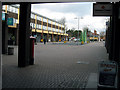
Hadley Shopping Centre, Telford
Overall view of the Hadley shopping centre, Telford, looking East.
Image: © Gordon Cragg
Taken: 19 Feb 2010
0.13 miles
9
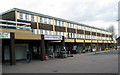
Hadley Shopping Centre, Telford
Hadley shopping centre,Telford.
Image: © Gordon Cragg
Taken: 19 Feb 2010
0.13 miles
10
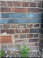
OS benchmark - Hadley, Methodist Church
An OS cutmark on the east wall (around to the left of the frontage in Image) which was originally levelled in 1958 at 86.405m above Ordnance Datum Newlyn.
Image: © Richard Law
Taken: 16 Jul 2016
0.14 miles