OS benchmark - Hadley, railway bridge on Hadley Park Road
Introduction
The photograph on this page of OS benchmark - Hadley, railway bridge on Hadley Park Road by Richard Law as part of the Geograph project.
The Geograph project started in 2005 with the aim of publishing, organising and preserving representative images for every square kilometre of Great Britain, Ireland and the Isle of Man.

There are currently over 7.5m images from over 14,400 individuals and you can help contribute to the project by visiting https://www.geograph.org.uk
OS benchmark - Hadley, railway bridge on Hadley Park Road
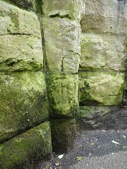
Image: © Richard Law Taken: 16 Jul 2016
It's barely visible on the weathered sandstone, and in a rather dank corner of the old railway bridge, but there is an OS cutmark in the middle of the shot, which was originally levelled in 1961 at 82.24m above Ordnance Datum Newlyn.
Images are licensed for reuse under creativecommons.org/licenses/by-sa/2.0
Image Location
Latitude
52.705827
Longitude
-2.487175