
IMAGES TAKEN NEAR TO
Holyhead Road, TELFORD, TF1 5AD
Introduction
This page details the photographs taken nearby to Holyhead Road, TF1 5AD by members of the Geograph project.
The Geograph project started in 2005 with the aim of publishing, organising and preserving representative images for every square kilometre of Great Britain, Ireland and the Isle of Man.

There are currently over 7.5m images from over14,400 individuals and you can help contribute to the project by visiting https://www.geograph.org.uk
Image Map
Images are licensed for reuse under creativecommons.org/licenses/by-sa/2.0
Notes
- Clicking on the map will re-center to the selected point.
- The higher the marker number, the further away the image location is from the centre of the postcode.
Image Listing (16 Images Found)
Images are licensed for reuse under creativecommons.org/licenses/by-sa/2.0
Image
Details
Distance
1
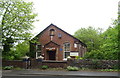
Seventh-Day Adventist Church, Ketley Brook, Telford
Image: © JThomas
Taken: 18 May 2019
0.01 miles
2
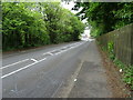
Holyhead Road (B5061), Ketley Brook, Telford
Looking east.
Image: © JThomas
Taken: 18 May 2019
0.03 miles
3
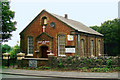
Seventh Day Adventist Church,Holyhead Rd, Ketley
This modern day church is in a converted Primitive Methodist chapel originally built in 1863. On the North side of the Holyhead Road (the old A5), which at this point is on the embankment built by Thomas Telford when he improved this great turnpike road in the 1820s. The rear entrance to the church is on the lower (old) road about 30-40 feet down the embankment.
Image: © Gordon Cragg
Taken: 12 Aug 2003
0.03 miles
4
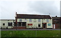
The Horseshoes Inn, Ketley
On Holyhead Road.
Image: © JThomas
Taken: 18 May 2019
0.08 miles
5
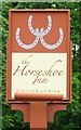
Sign for the Horseshoes Inn, Ketley
Did someone forget the "S".
See Image] for context.
Image: © JThomas
Taken: 18 May 2019
0.09 miles
6
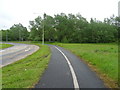
Dual use path beside roundabout on the A5223
Image: © JThomas
Taken: 18 May 2019
0.12 miles
7
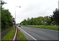
Whitchurch Drive (A5223)
Looking south towards Junction 6 of the M54 Motorway.
Image: © JThomas
Taken: 18 May 2019
0.12 miles
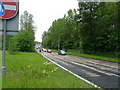
9
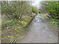
Remains of Ketley station platform and trackbed
Looking due south toward Horsehay, the remains of this station on the Wellington-Craven Arms branch (closed piecemeal from the 1930s to the 1960s) have been unused since 1961. The trackbed is now a public footpath. Taken from the former site of a level crossing across what in railway days was the A5 trunk road.
Image: © Peter Whatley
Taken: 11 Apr 2008
0.21 miles
10
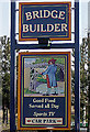
Bridge Builder Inn Sign, Ketley
The attractive sign outside the Bridge Builder public house on the Wellington Retail Park. Pub photo here--Image
Image: © Gordon Cragg
Taken: Unknown
0.22 miles