
IMAGES TAKEN NEAR TO
Lime Tree Way, TELFORD, TF1 3PJ
Introduction
This page details the photographs taken nearby to Lime Tree Way, TF1 3PJ by members of the Geograph project.
The Geograph project started in 2005 with the aim of publishing, organising and preserving representative images for every square kilometre of Great Britain, Ireland and the Isle of Man.

There are currently over 7.5m images from over14,400 individuals and you can help contribute to the project by visiting https://www.geograph.org.uk
Image Map
Images are licensed for reuse under creativecommons.org/licenses/by-sa/2.0
Notes
- Clicking on the map will re-center to the selected point.
- The higher the marker number, the further away the image location is from the centre of the postcode.
Image Listing (24 Images Found)
Images are licensed for reuse under creativecommons.org/licenses/by-sa/2.0
Image
Details
Distance
1
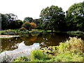
Little Apley Pool, Wellington
A fishing pool in an area of parkland on the south side of Apley Avenue.
Image: © Jaggery
Taken: 10 Oct 2013
0.11 miles
2
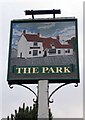
The Park pub sign
A pub sign depicting the pub shows a woeful lack of imagination. Discuss.
Outside Image
Image: © Mike White
Taken: 5 Mar 2010
0.13 miles
3
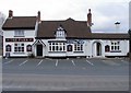
The Park, Park St
This pub stands opposite Image but they both seem to be prospering.
Image: © Mike White
Taken: 5 Mar 2010
0.13 miles
4
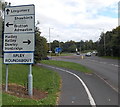
Locations near Wellington Shropshire
The sign is alongside Apley Avenue on the approach to Apley Roundabout.
Why are no distances shown?
Image: © Jaggery
Taken: 10 Oct 2013
0.15 miles
5
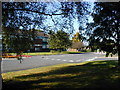
Blessed Robert Johnson Catholic College
The only Catholic Secondary school (11-18, including the Oscar Romero Sixth Form Centre) in Shropshire, opened in the 1950s, but much expanded.
Image: © Bob Bowyer
Taken: 23 Sep 2005
0.16 miles
6
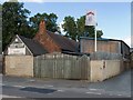
Shed City, Wellington
I expect they sell a lot of sheds. It certainly seems the place to come to for all your shed needs. 'Shop' seems too humble a category for it.
Image: © Mike White
Taken: 1 Jul 2008
0.16 miles
7
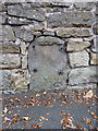
OS benchmark - Wellington, boundary stone on Whitchurch Road
An OS cutmark on the remains of a milestone Image set into the roadside wall, just north of Wellington. Note the bolt holes that would have originally held the iron (?) plate, which has presumably been liberated by some enterprising rapscalion with an eye for scrap metal prices; very helpful, well done. The benchmark was originally levelled in 1958 at 103.631m above Ordnance Datum Newlyn.
Image: © Richard Law
Taken: 18 Oct 2015
0.17 miles
8
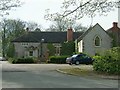
Apley residence
Buildings in a quiet cul-de-sac near Apley Castle
Image: © Andy and Hilary
Taken: 17 Apr 2005
0.17 miles
9
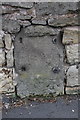
Old Milestone by Whitchurch Road, Wellington
Stone post (plate lost) by the UC road, in parish of WELLINGTON (TELFORD AND WREKIN District), Whitchurch Road, just South of junction with Apley Avenue, in wall, on East side of road. Erected by the Watling Street, Wellington District turnpike trust in the 19th century.
Inscription once read:-
(Watling)
(Street)
(1)
Milestone Society National ID: SA_WS01.
Image: © J Haynes
Taken: 1 Aug 2009
0.17 miles
10
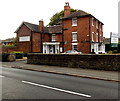
Grove House hotel & restaurant, Wellington
Viewed across Whitchurch Road.
Image: © Jaggery
Taken: 10 Oct 2013
0.17 miles