1
Main entrance to Wrekin College, Wellington
Viewed across Sutherland Road. Wrekin College is a co-educational boarding and day school for pupils aged 11-18.
Image: © Jaggery
Taken: 10 Oct 2013
0.10 miles
2
Wellington - Wrekin College
One of the College buildings south of Sutherland Road.
Image: © Dave Bevis
Taken: 22 Sep 2012
0.12 miles
3
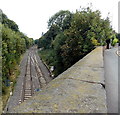
Railway cutting east of King Street bridge, Wellington
Looking east away from Wellington railway station.
The next stations ahead are Oakengates and Telford Central.
Image: © Jaggery
Taken: 10 Oct 2013
0.12 miles
4
Memorial Hall, Wrekin College, Wellington
Viewed across Sutherland Road. Part of Wrekin College, the Memorial Hall is a large banqueting hall with a stage, bar and upstairs gallery for events up to 250 people. This is one of several college buildings that can be booked for conferencing, meetings, wedding receptions, craft fairs etc.
Image: © Jaggery
Taken: 10 Oct 2013
0.12 miles
5
Footbridge over the railway line
Image: © N Chadwick
Taken: 18 Feb 2015
0.13 miles
6
OS benchmark & bridge dedication plaque - Wellington, King Street
An OS cutmark (highlighted by the paint) lies at the foot of the bricks on this bridge over the Wolverhampton to Shrewsbury line, and was originally levelled at 98.187m above Ordnance Datum Newlyn. The lettering on the stone plaque in the background has not stood the test of time well, and the only legible word appears to be 'engineer', which suggests it records the design or erection of the bridge.
Image: © Richard Law
Taken: 8 Dec 2013
0.17 miles
7
Kaz's Kutz in Wellington
Barber shop on the corner of Constitution Hill and King Street.
Image: © Jaggery
Taken: 10 Oct 2013
0.18 miles
8
Cock Hotel and old A5
The Cock Hotel is a former coaching inn situated on the A5 or London-Holyhead Road, formerly the Roman road of Watling Street. The development along the road is still known as Watling Street. It is south of the town of Wellington - the road to the right is Mill Bank named after a long disappeared windmill.
Image: © Bob Bowyer
Taken: 3 Sep 2005
0.18 miles
9
Drill Hall - King Street
Image] Emblem of the Artillery Volunteers.
The motto of the Royal Artillery translates as 'Always, where right and glory lead'.
Image: © John M
Taken: 1 Feb 2014
0.18 miles
10
Constitution Hill Wellington
Viewed across King Street.
Image: © Jaggery
Taken: 10 Oct 2013
0.18 miles


