OS benchmark & bridge dedication plaque - Wellington, King Street
Introduction
The photograph on this page of OS benchmark & bridge dedication plaque - Wellington, King Street by Richard Law as part of the Geograph project.
The Geograph project started in 2005 with the aim of publishing, organising and preserving representative images for every square kilometre of Great Britain, Ireland and the Isle of Man.

There are currently over 7.5m images from over 14,400 individuals and you can help contribute to the project by visiting https://www.geograph.org.uk
OS benchmark & bridge dedication plaque - Wellington, King Street
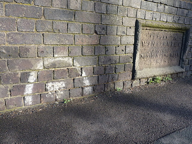
Image: © Richard Law Taken: 8 Dec 2013
An OS cutmark (highlighted by the paint) lies at the foot of the bricks on this bridge over the Wolverhampton to Shrewsbury line, and was originally levelled at 98.187m above Ordnance Datum Newlyn. The lettering on the stone plaque in the background has not stood the test of time well, and the only legible word appears to be 'engineer', which suggests it records the design or erection of the bridge.
Images are licensed for reuse under creativecommons.org/licenses/by-sa/2.0
Image Location
Latitude
52.701045
Longitude
-2.512545