
IMAGES TAKEN NEAR TO
Crescent Road, TELFORD, TF1 3DJ
Introduction
This page details the photographs taken nearby to Crescent Road, TF1 3DJ by members of the Geograph project.
The Geograph project started in 2005 with the aim of publishing, organising and preserving representative images for every square kilometre of Great Britain, Ireland and the Isle of Man.

There are currently over 7.5m images from over14,400 individuals and you can help contribute to the project by visiting https://www.geograph.org.uk
Image Map
Images are licensed for reuse under creativecommons.org/licenses/by-sa/2.0
Notes
- Clicking on the map will re-center to the selected point.
- The higher the marker number, the further away the image location is from the centre of the postcode.
Image Listing (177 Images Found)
Images are licensed for reuse under creativecommons.org/licenses/by-sa/2.0
Image
Details
Distance
1
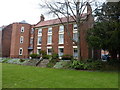
Parville House, Wellington
A rather fine, 18th century (Georgian) town house, which attracted a Grade II listing https://britishlistedbuildings.co.uk/101292509-parville-house-wellington#.XKzccphKjIU & https://historicengland.org.uk/listing/the-list/list-entry/1292509 in 1983. Now converted to social housing.
Image: © Richard Law
Taken: 8 Apr 2019
0.03 miles
2
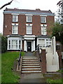
The former offices of Severn Trent Water, Wellington
More properly known as 22 Vineyard Road, this late 18th century town house was Grade II listed https://britishlistedbuildings.co.uk/101033329-severn-trent-water-authority-wellington#.XKze15hKjIU & https://historicengland.org.uk/listing/the-list/list-entry/1033329 in 1983; the bay window and fancy columns around the porch are a later addition.
Image: © Richard Law
Taken: 8 Apr 2019
0.03 miles
3
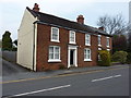
26 Vineyard Road, Wellington
Built in the late 18th century, and Grade II listed https://britishlistedbuildings.co.uk/101209967-26-vineyard-road-wellington#.XKzgoJhKjIU & https://historicengland.org.uk/listing/the-list/list-entry/1209967 in 1983; the ground floor windows are rather more recent.
Image: © Richard Law
Taken: 8 Apr 2019
0.05 miles
4
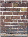
OS benchmark - Wellington, Vineyard Road
A rather poor example of the ilk, to be honest I'm not convinced this is the real thing, as the OS would rarely cut the datum line into the mortar of a brick wall. However, it's at the correct grid ref, and matches the description of a mark described in the OS database, so I have recorded it as such. Originally levelled in 1966 at 96.646m above Ordnance Datum Newlyn.
Image: © Richard Law
Taken: 5 Jul 2014
0.05 miles
7
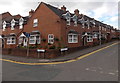
Corner of Cambrian Row and Cambrian Row, Wellington
Cambrian Row (Park Street) is on the left. Cambrian Row (The Lawns) is on the right.
Image: © Jaggery
Taken: 10 Oct 2013
0.08 miles
8
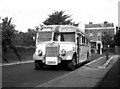
Local bus to High Ercall
In the 1960s, local bus services in and around Wellington, Shropshire were provided either by Midland Red or by a variety of independent operators. One of the independents was Butter's, whose Leyland TS8 is seen here in Charlton Street, Wellington on a service to High Ercall - a longish run through the lanes.
Image: © Dr Neil Clifton
Taken: 31 Aug 1963
0.08 miles
9
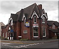
49 Church Street, Wellington
The distinctive building on the corner of Church Street and Vineyard Yard was for sale at the early October 2013 date of this view. Until January 2013, it was the Wellington office of Lanyon Bowdler solicitors. The office closed after relocation to larger offices at Hazledine House in nearby Telford.
Image: © Jaggery
Taken: 10 Oct 2013
0.09 miles
10
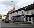
Joanne's Fryzjer in Wellington
Joanne's Fryzjer hairdressing salon is on the right. Fryzjer is Polish for hairdresser.
Next door is West Midlands Solicitors at 2 Park Street.
On the left, a postman is pushing a red postal trolley.
Image: © Jaggery
Taken: 10 Oct 2013
0.09 miles