IMAGES TAKEN NEAR TO
Dawley Road, TELFORD, TF1 2LZ
Introduction
This page details the photographs taken nearby to Dawley Road, TF1 2LZ by members of the Geograph project.
The Geograph project started in 2005 with the aim of publishing, organising and preserving representative images for every square kilometre of Great Britain, Ireland and the Isle of Man.

There are currently over 7.5m images from over14,400 individuals and you can help contribute to the project by visiting https://www.geograph.org.uk
Image Map
Images are licensed for reuse under creativecommons.org/licenses/by-sa/2.0
Notes
- Clicking on the map will re-center to the selected point.
- The higher the marker number, the further away the image location is from the centre of the postcode.
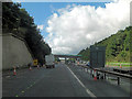
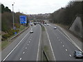
Image Listing (12 Images Found)
Images are licensed for reuse under creativecommons.org/licenses/by-sa/2.0
Image
Details
Distance
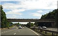
1
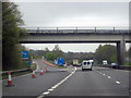
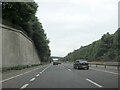
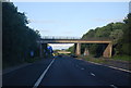
M54 Motorway - Dawley Road overbridge
Image: © Peter Whatley
Taken: 18 Jan 2011
0.05 miles
3
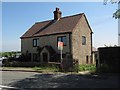
Old Toll House, Arleston
Toll House in the parish of Wellington, Arleston Toll House, Dawley Road, Wellington.
To be surveyed
Milestone Society National ID: SA.WEL
Image: © Milestone Society
Taken: Unknown
0.11 miles
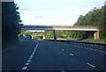
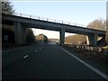
9
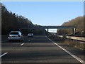
M54 Motorway - Arleston Lane overbridge
Image: © Peter Whatley
Taken: 18 Jan 2011
0.16 miles