IMAGES TAKEN NEAR TO
Orwell Crescent, TELFORD, TF1 2GE
Introduction
This page details the photographs taken nearby to Orwell Crescent, TF1 2GE by members of the Geograph project.
The Geograph project started in 2005 with the aim of publishing, organising and preserving representative images for every square kilometre of Great Britain, Ireland and the Isle of Man.

There are currently over 7.5m images from over14,400 individuals and you can help contribute to the project by visiting https://www.geograph.org.uk
Image Map
Images are licensed for reuse under creativecommons.org/licenses/by-sa/2.0
Notes
- Clicking on the map will re-center to the selected point.
- The higher the marker number, the further away the image location is from the centre of the postcode.
Image Listing (9 Images Found)
Images are licensed for reuse under creativecommons.org/licenses/by-sa/2.0
Image
Details
Distance
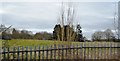
2
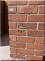
OS benchmark - Wellington, 36 Steventon Road
A clear OS cutmark in the front wall of no 36 Steventon Road (right outside the front door); originally levelled in 1966 at 93.02m above Ordnance Datum Newlyn.
Image: © Richard Law
Taken: 5 Jul 2014
0.14 miles
5
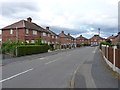
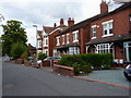
Clift Crescent, Wellington
1950s (?) council housing in the western side of Wellington
Image: © Richard Law
Taken: 6 Aug 2011
0.20 miles
6
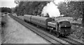
Local train from Crewe approaching Market Drayton Junction, Wellington
View NW, towards Market Drayton, Nantwich and Crewe: ex-GW Wellington - Nantwich ( - Crewe) line, which was important especially for freight but was closed 9/9/63 for passenger traffic, 11/5/67 completely. Here the 13.02 from Crewe is headed by the engine which when withdrawn from service in 11/66 had the distinction of being the very last GW (standard gauge) locomotive to run on BR: '8750' class 0-6-0PT No. 9774 (built 3/36).
Image: © Ben Brooksbank
Taken: 26 Aug 1963
0.22 miles
7
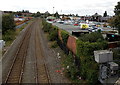
Railway west of Bridge Road Wellington
Looking west from Bridge Road towards a railway footbridge about 300 metres ahead.
A Morrisons store is on the right.
Image: © Jaggery
Taken: 10 Oct 2013
0.24 miles
8
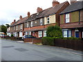
Springfield Cottages on Orleton Road
Built in 1906, this row of houses is near the junction with Wrockwardine Road
Image: © Richard Law
Taken: 6 Aug 2011
0.24 miles