
IMAGES TAKEN NEAR TO
Herbert Avenue, TELFORD, TF1 2BT
Introduction
This page details the photographs taken nearby to Herbert Avenue, TF1 2BT by members of the Geograph project.
The Geograph project started in 2005 with the aim of publishing, organising and preserving representative images for every square kilometre of Great Britain, Ireland and the Isle of Man.

There are currently over 7.5m images from over14,400 individuals and you can help contribute to the project by visiting https://www.geograph.org.uk
Image Map
Images are licensed for reuse under creativecommons.org/licenses/by-sa/2.0
Notes
- Clicking on the map will re-center to the selected point.
- The higher the marker number, the further away the image location is from the centre of the postcode.
Image Listing (23 Images Found)
Images are licensed for reuse under creativecommons.org/licenses/by-sa/2.0
Image
Details
Distance
1
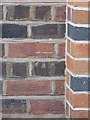
OS benchmark - Wellington, 32 Herbert Avenue
An OS cutmark in the brickwork at the side of 32 Herbert Avenue; originally levelled at 108.08m above Ordnance Datum Newlyn.
Image: © Richard Law
Taken: 5 Jul 2014
0.08 miles
2
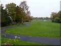
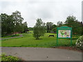
Bowring Park, Wellington
A public park, developed on land bequeathed to the town in 1910 by Ann Bowring, the wife of a wealthy businessman and fish trader, who lived locally. The original park grounds, including tennis courts, allotments, paths and toilets, were extended in the 1950s when more land was acquired by the then Urban District Council, and further facilities such as the football and cricket pitches here at the southern end of the park were added.
Image: © Richard Law
Taken: 31 Oct 2010
0.10 miles
3
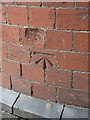
OS benchmark - Wellington, Haygate Road
A clear OS cutmark on the wall on the NW side of Haygate Road, just NE of the junction with Powder Lane; originally levelled in 1966 at 104.751m above Ordnance Datum Newlyn.
Image: © Richard Law
Taken: 5 Jul 2014
0.11 miles
4

Powder Lane Benchmark
The Ordnance Survey Cut benchmark on the wall next to the entrance to Powder Lane on Haygate Road, Wellington, Telford. It is next to the Postbox
Image: © Anthony Rowley
Taken: 17 Jul 2021
0.12 miles
5
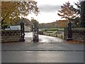
Recreational Gardens, Haygate Rd
Public conveniences, tennis courts and a bowling green are included in the amenities provided.
Image: © Mike White
Taken: 28 Oct 2008
0.13 miles
6
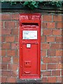
Postbox, Haygate Rd
VR postbox at corner of Haygate Road and Powder Lane. Note crack extending from the wall into the cast iron of the box itself.
Image: © Mike White
Taken: 28 Oct 2008
0.14 miles
9
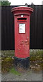
George V postbox on Holyhead Road, Wellington
Postbox No. TF1 191.
See Image] for context.
Image: © JThomas
Taken: 18 May 2019
0.16 miles
10
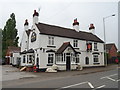
The Red Lion, Wellington
On Holyhead Road.
Image: © JThomas
Taken: 18 May 2019
0.16 miles