
IMAGES TAKEN NEAR TO
Bridge Road, BROSELEY, TF12 5QS
Introduction
This page details the photographs taken nearby to Bridge Road, TF12 5QS by members of the Geograph project.
The Geograph project started in 2005 with the aim of publishing, organising and preserving representative images for every square kilometre of Great Britain, Ireland and the Isle of Man.

There are currently over 7.5m images from over14,400 individuals and you can help contribute to the project by visiting https://www.geograph.org.uk
Image Map
Images are licensed for reuse under creativecommons.org/licenses/by-sa/2.0
Notes
- Clicking on the map will re-center to the selected point.
- The higher the marker number, the further away the image location is from the centre of the postcode.
Image Listing (41 Images Found)
Images are licensed for reuse under creativecommons.org/licenses/by-sa/2.0
Image
Details
Distance
1
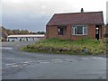
Derelict Bungalow, Broseley
This modern bungalow on the way to the Cricket Club seems abandoned. I wonder what went wrong? It's a sad sight.
Image: © Mike White
Taken: 2 Nov 2008
0.15 miles
4
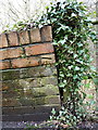
OS benchmark - Ironbridge, Bridge Road wall
An OS cutmark in a wall bounding the east side of Bridge Road, which climbs steeply above Ironbridge towards Broseley. Originally levelled at 69.994m above Ordnance Datum Newlyn. Judging by the fact that the horizontal cut isn't level any more, the upper courses of bricks may well have been rebuilt since its original creation.
Image: © Richard Law
Taken: 15 Feb 2014
0.19 miles
6
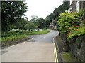
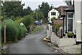
Looking from the Toll House along Ladywood
Image: © Basher Eyre
Taken: 12 Aug 2009
0.21 miles
8
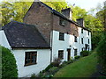
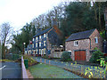
Mill Cottage, Bower Yard, Ironbridge
Thought to date from the early 19th century, and actually now consisting of two separate houses; Grade II listed https://britishlistedbuildings.co.uk/101207398-mill-cottage-the-gorge#.XqR-amhKjcs & https://historicengland.org.uk/listing/the-list/list-entry/1207398 in 1974.
Image: © Richard Law
Taken: 24 Apr 2020
0.21 miles
10
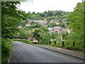
Ironbridge viewed from Bridge Road
Bridge Road descends steeply into Ironbridge providing a fine view of this historic industrial gorge.
Image: © Philip Halling
Taken: 2 Jun 2021
0.22 miles