OS benchmark - Ironbridge, Bridge Road wall
Introduction
The photograph on this page of OS benchmark - Ironbridge, Bridge Road wall by Richard Law as part of the Geograph project.
The Geograph project started in 2005 with the aim of publishing, organising and preserving representative images for every square kilometre of Great Britain, Ireland and the Isle of Man.

There are currently over 7.5m images from over 14,400 individuals and you can help contribute to the project by visiting https://www.geograph.org.uk
OS benchmark - Ironbridge, Bridge Road wall
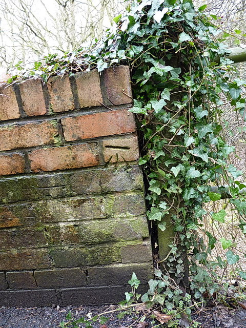
Image: © Richard Law Taken: 15 Feb 2014
An OS cutmark in a wall bounding the east side of Bridge Road, which climbs steeply above Ironbridge towards Broseley. Originally levelled at 69.994m above Ordnance Datum Newlyn. Judging by the fact that the horizontal cut isn't level any more, the upper courses of bricks may well have been rebuilt since its original creation.
Images are licensed for reuse under creativecommons.org/licenses/by-sa/2.0
Image Location
Latitude
52.625644
Longitude
-2.485648