
IMAGES TAKEN NEAR TO
Stamford Court, TELFORD, TF1 1YY
Introduction
This page details the photographs taken nearby to Stamford Court, TF1 1YY by members of the Geograph project.
The Geograph project started in 2005 with the aim of publishing, organising and preserving representative images for every square kilometre of Great Britain, Ireland and the Isle of Man.

There are currently over 7.5m images from over14,400 individuals and you can help contribute to the project by visiting https://www.geograph.org.uk
Image Map
Images are licensed for reuse under creativecommons.org/licenses/by-sa/2.0
Notes
- Clicking on the map will re-center to the selected point.
- The higher the marker number, the further away the image location is from the centre of the postcode.
Image Listing (254 Images Found)
Images are licensed for reuse under creativecommons.org/licenses/by-sa/2.0
Image
Details
Distance
1
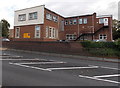
Citizens Advice Bureau, Wellington
The yellow Citizens Advice Bureau name sign is on the wall
of the building on the corner of Victoria Road and Tan Bank.
Image: © Jaggery
Taken: 10 Oct 2013
0.03 miles
3
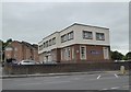
Wellington: Citizens Advice Bureau
Image: © Jonathan Hutchins
Taken: 1 Jun 2016
0.04 miles
4
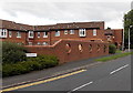
5 round holes in the wall, Roseway, Wellington
The holes are a design feature. Viewed from the Wrekin Road end of Roseway.
Image: © Jaggery
Taken: 10 Oct 2013
0.04 miles
5
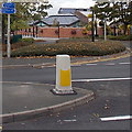
Cycle route distances from Victoria Road, Wellington
The blue sign pointing left shows 2 (miles) to Wrockwardine and 14 to Shrewsbury.
The sign pointing right shows 4½ to Oakengates and 25½ to Wolverhampton.
Part of National Cycle Network route 81.
Image: © Jaggery
Taken: 10 Oct 2013
0.05 miles
6
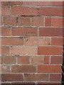
OS benchmark - Wellington, former Wrekin Road school
An OS cutmark on the wall of the former school in Wrekin Road (which is currently being converted to apartments). It was originally levelled in 1966 at 102.721m above Ordnance Datum Newlyn.
Image: © Richard Law
Taken: 5 Jul 2014
0.05 miles
7
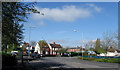
Three Way Junction, Wellington
The junction of Bridge Street, Wrekin Road and Victoria Road, Wellington.
Image: © Gordon Cragg
Taken: 21 Apr 2009
0.06 miles
8
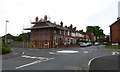
Wellington: mini-roundabout on Wrekin Road
Image: © Jonathan Hutchins
Taken: 1 Jun 2016
0.06 miles
9
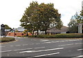
Victoria Road entrance to Wellington Civic & Leisure Centre
This way to Wellington Town Council offices, the Register Office, library, leisure centre and a cafe.
Image: © Jaggery
Taken: 10 Oct 2013
0.06 miles
10
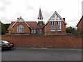
Tower, 62 Wrekin Road, Wellington
This is the NW corner of a former Telford and Wrekin Council day care centre.
Image: © Jaggery
Taken: 10 Oct 2013
0.06 miles