
IMAGES TAKEN NEAR TO
St. James Court, TELFORD, TF1 1QF
Introduction
This page details the photographs taken nearby to St. James Court, TF1 1QF by members of the Geograph project.
The Geograph project started in 2005 with the aim of publishing, organising and preserving representative images for every square kilometre of Great Britain, Ireland and the Isle of Man.

There are currently over 7.5m images from over14,400 individuals and you can help contribute to the project by visiting https://www.geograph.org.uk
Image Map
Images are licensed for reuse under creativecommons.org/licenses/by-sa/2.0
Notes
- Clicking on the map will re-center to the selected point.
- The higher the marker number, the further away the image location is from the centre of the postcode.
Image Listing (161 Images Found)
Images are licensed for reuse under creativecommons.org/licenses/by-sa/2.0
Image
Details
Distance
1
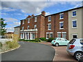
The Mount, Wellington
The central, redbrick part of this building is an early 19th century house. Its construction date is not recorded but it was Grade II listed https://britishlistedbuildings.co.uk/101033319-the-mount-wellington#.YvKVLnbMLIU & https://historicengland.org.uk/listing/the-list/list-entry/1033319 in 1983 and is now converted to flats and apartments.
Image: © Richard Law
Taken: 6 Aug 2022
0.04 miles
2
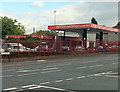
Peter Morris Cars, Wellington
Used car business viewed across Wrekin Road from the corner of Haygate Road.
Image: © Jaggery
Taken: 10 Oct 2013
0.06 miles
3
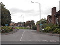
Union Street, Wellington
Viewed from Wrekin Road. The Wrekin Inn http://www.geograph.org.uk/photo/3705284 is on the right.
Image: © Jaggery
Taken: 10 Oct 2013
0.06 miles
5
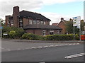
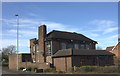
Wrekin Inn, Wellington
On the corner of Wrekin Road and Union Road.
Image: © Jaggery
Taken: 10 Oct 2013
0.07 miles
6
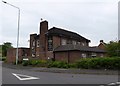
Wellington: The Wrekin public house
Image: © Jonathan Hutchins
Taken: 1 Jun 2016
0.07 miles
7
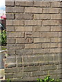
OS benchmark - Wellington, The Haygate pub
A clear OS cutmark on the wall of The Haygate pub; originally levelled in 1966 at 96.55m above Ordnance Datum Newlyn. Updated note Jan 2019 - this mark has probably now been destroyed. The current edition of the local paper reports that the pub is being demolished this week, and the mark's quite likely a goner as a result. (I can confirm in 2022 that is the case; the pub has now been demolished)
Image: © Richard Law
Taken: 5 Jul 2014
0.08 miles
8
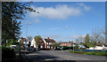
Three Way Junction, Wellington
The junction of Bridge Street, Wrekin Road and Victoria Road, Wellington.
Image: © Gordon Cragg
Taken: 21 Apr 2009
0.09 miles
9
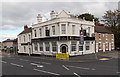
Taj Mahal, Wellington
Tandoori and Indian cuisine restaurant on the corner of Bridge Road and Walker Street.
The building used to be Porter's Ale House.
Image: © Jaggery
Taken: 10 Oct 2013
0.09 miles
10
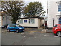
Mid Counties Brokers, Wellington
Insurance brokers' office at 48A Walker Street.
Image: © Jaggery
Taken: 10 Oct 2013
0.10 miles