IMAGES TAKEN NEAR TO
Park Lane, SHIFNAL, TF11 9PD
Introduction
This page details the photographs taken nearby to Park Lane, TF11 9PD by members of the Geograph project.
The Geograph project started in 2005 with the aim of publishing, organising and preserving representative images for every square kilometre of Great Britain, Ireland and the Isle of Man.

There are currently over 7.5m images from over14,400 individuals and you can help contribute to the project by visiting https://www.geograph.org.uk
Image Map
Images are licensed for reuse under creativecommons.org/licenses/by-sa/2.0
Notes
- Clicking on the map will re-center to the selected point.
- The higher the marker number, the further away the image location is from the centre of the postcode.
Image Listing (79 Images Found)
Images are licensed for reuse under creativecommons.org/licenses/by-sa/2.0
Image
Details
Distance
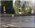
2
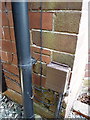
OS benchmark - Holmlea on Park Lane
A cutmark in the brickwork of a house called Holmlea, just past St Andrews C of E Primary School. Levelled at 88.0232m, 288'9" above Ordnance Datum Nelwyn.
Image: © Richard Law
Taken: 28 Jul 2013
0.05 miles
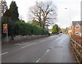
3
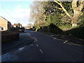
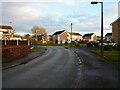
The southern end of a cul de sac off Brimstree Drive
Most of the estate houses here were built in the last 1960s or early '70s, although the red-brick place on the right here looks like a very recent addition. No brownie points for the van on the left, which is parked wholly blocking the pavement.... very inconsiderate.
Image: © Richard Law
Taken: 20 Dec 2020
0.05 miles
4
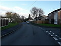
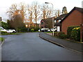
Brimstree Drive
Late 1960s housing on the southwest side of Shifnal.
Image: © Richard Law
Taken: 12 Dec 2020
0.06 miles
5
Houses on Brimstree Drive
Built, if memory serves me correctly, in the early 1970s or shortly before, and part of an estate that leads down to Image
Image: © Richard Law
Taken: 20 Dec 2020
0.07 miles
6
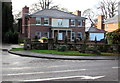
Brooklands, Shifnal
Detached house set back from the A464 in the south of Shifnal.
Image: © Jaggery
Taken: 26 Nov 2015
0.07 miles
7
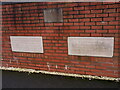
Rescued foundation stones from the old Cottage Hospital
When the houses on Cottage Drive Image were built in 2002, these two foundation stones were saved from the demolished Cottage Hospital which had stood here since the late 1930s, and were preserved by incorporation into a section of garden wall.
Image: © Richard Law
Taken: 20 Dec 2020
0.07 miles
8
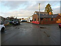
Houses at the eastern end of Cottage Drive
Part of a development built in 2002, occupying the site of the one-time town Cottage Hospital
Image: © Richard Law
Taken: 20 Dec 2020
0.07 miles
9
Warning signs facing the A464 in the south of Shifnal
The top sign warns that a school is ahead. The sign below it is stereotypical depiction of the elderly.
Image: © Jaggery
Taken: 26 Nov 2015
0.08 miles
10
Warning sign - minor road junction at bend, Shifnal
The sign is alongside the A464 in the south of Shifnal.
Image: © Jaggery
Taken: 26 Nov 2015
0.08 miles