
IMAGES TAKEN NEAR TO
Dingle Drive, SHIFNAL, TF11 9DW
Introduction
This page details the photographs taken nearby to Dingle Drive, TF11 9DW by members of the Geograph project.
The Geograph project started in 2005 with the aim of publishing, organising and preserving representative images for every square kilometre of Great Britain, Ireland and the Isle of Man.

There are currently over 7.5m images from over14,400 individuals and you can help contribute to the project by visiting https://www.geograph.org.uk
Image Map
Images are licensed for reuse under creativecommons.org/licenses/by-sa/2.0
Notes
- Clicking on the map will re-center to the selected point.
- The higher the marker number, the further away the image location is from the centre of the postcode.
Image Listing (91 Images Found)
Images are licensed for reuse under creativecommons.org/licenses/by-sa/2.0
Image
Details
Distance
1
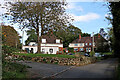
Houses by Madeley Lane in Beckbury, Shropshire
Looking east as the lane enters the village.
Image: © Roger Kidd
Taken: 16 Oct 2022
0.01 miles
2
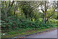
Woodland by Madeley Road near Beckbury, Shropshire
The steep public footpath into the wood was almost completely overgrown with bracken and brambles in October 2022. I couldn't be bothered after checking out the first twenty metres. :-(
Image: © Roger Kidd
Taken: 8 Oct 2022
0.03 miles
3
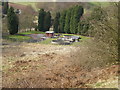
Beckbury Sewage Works
The Severn-Trent sewage works in the valley of the River Worfe
Image: © Richard Law
Taken: 28 Mar 2010
0.08 miles
4
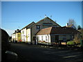
'Seven Stars' public house.
Real, real ale served in this pub.
Image: © Row17
Taken: 11 Dec 2007
0.08 miles
5
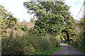
Madeley Road west of Beckbury in Shropshire
Looking east towards Beckbury. The bridge ahead crosses the River Worfe.
Portrait image: Image]
Image: © Roger Kidd
Taken: 16 Oct 2022
0.10 miles
6
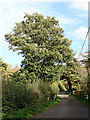
Madeley Road west of Beckbury in Shropshire
Looking east towards Beckbury. The bridge ahead crosses the River Worfe.
Landscape image: Image]
Image: © Roger Kidd
Taken: 16 Oct 2022
0.10 miles
7
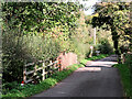
Madeley Road west of Beckbury in Shropshire
Looking east towards the village, and crossing the River Worfe.
Image: © Roger Kidd
Taken: 16 Oct 2022
0.10 miles
8
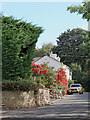
Madeley Road entering Beckbury in Shropshire
Looking east, the Smokey Cow (formerly Seven Stars) public house is at the end of the row of cottages. That flamboyant red display of leaves had gone eight days later!
The Monarch's Way and the Cross Britain Way paths both pass through here. https://en.wikipedia.org/wiki/Cross_Britain_Way https://en.wikipedia.org/wiki/Monarch%27s_Way https://www.ramblers.org.uk/news/walk-magazine/current-issue/2021/may/summer-2021/monarchs-way.aspx
Image: © Roger Kidd
Taken: 8 Oct 2022
0.11 miles
9
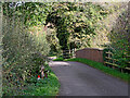
Bridge over the River Worfe near Beckbury
Madeley Road is approaching the village of Beckbury from the west.
Image: © Roger Kidd
Taken: 16 Oct 2022
0.12 miles
10
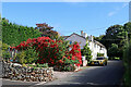
Dazzling autumn foliage in Beckbury, Shropshire
This is Madeley Road entering Beckbury village. The Smokey Cow (formerly Seven Stars) public house is at the end of the row of cottages. A week later nearly all the leaves had fallen off!
The Monarch's Way and the Cross Britain Way paths both pass through here. https://en.wikipedia.org/wiki/Cross_Britain_Way https://en.wikipedia.org/wiki/Monarch%27s_Way https://www.ramblers.org.uk/news/walk-magazine/current-issue/2021/may/summer-2021/monarchs-way.aspx
Image: © Roger Kidd
Taken: 8 Oct 2022
0.13 miles