IMAGES TAKEN NEAR TO
Lloyd Grove, SHIFNAL, TF11 9AS
Introduction
This page details the photographs taken nearby to Lloyd Grove, TF11 9AS by members of the Geograph project.
The Geograph project started in 2005 with the aim of publishing, organising and preserving representative images for every square kilometre of Great Britain, Ireland and the Isle of Man.

There are currently over 7.5m images from over14,400 individuals and you can help contribute to the project by visiting https://www.geograph.org.uk
Image Map
Images are licensed for reuse under creativecommons.org/licenses/by-sa/2.0
Notes
- Clicking on the map will re-center to the selected point.
- The higher the marker number, the further away the image location is from the centre of the postcode.
Image Listing (120 Images Found)
Images are licensed for reuse under creativecommons.org/licenses/by-sa/2.0
Image
Details
Distance
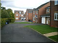
1
Lloyd Grove, Shifnal
Recently-built housing in the south of Shifnal, viewed across the A464 in late November 2015.
Image: © Jaggery
Taken: 26 Nov 2015
0.02 miles
2
Lloyd Grove, Shifnal
Recently-built housing in the south of Shifnal, viewed from the corner of A464 in late November 2015.
A July 2011 Google Earth Street View shows house construction work in progress here.
The houses in the background did not exist at that time.
Image: © Jaggery
Taken: 26 Nov 2015
0.02 miles
3
Hollyhead Road electricity substation, Shifnal
The Western Power Distribution electricity substation is set back from the east side of the A464, at the northern edge of recently-built houses in Lloyd Grove. The substation does not appear in a July 2011 Google Earth Street View. The substation identifier is HOLLYHEAD ROAD S/S 01617. This looks like an error for HOLYHEAD ROAD, though maps do not show the A464 as Holyhead Road until it is near Albrighton, to the southeast.
Image: © Jaggery
Taken: 26 Nov 2015
0.03 miles
5
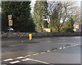
Warning signs facing the A464 in the south of Shifnal
The top sign warns that a school is ahead. The sign below it is stereotypical depiction of the elderly.
Image: © Jaggery
Taken: 26 Nov 2015
0.03 miles
6
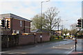
Recently installed pelican crossing in the south of Shifnal
Across the A464 near recently-built housing, viewed in late November 2015.
There was no crossing here in a July 2011 Google Earth Street View.
Image: © Jaggery
Taken: 26 Nov 2015
0.04 miles
7
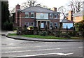
Brooklands, Shifnal
Detached house set back from the A464 in the south of Shifnal.
Image: © Jaggery
Taken: 26 Nov 2015
0.05 miles
8
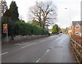
Warning sign - minor road junction at bend, Shifnal
The sign is alongside the A464 in the south of Shifnal.
Image: © Jaggery
Taken: 26 Nov 2015
0.07 miles
9
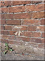
OS benchmark - Park Farm
A cutmark in the wall bounding the north side of the A464 leaving Shifnal. The mark itself is rather obscured by a patch of paint outlining it, but can be felt more clearly with fingers on the brickwork. Levelled at a height of 84.01m, 275'7" above Ordnance Datum Newlyn.
Image: © Richard Law
Taken: 28 Jul 2013
0.07 miles