IMAGES TAKEN NEAR TO
Collingwood Court, SHIFNAL, TF11 8TX
Introduction
This page details the photographs taken nearby to Collingwood Court, TF11 8TX by members of the Geograph project.
The Geograph project started in 2005 with the aim of publishing, organising and preserving representative images for every square kilometre of Great Britain, Ireland and the Isle of Man.

There are currently over 7.5m images from over14,400 individuals and you can help contribute to the project by visiting https://www.geograph.org.uk
Image Map
Images are licensed for reuse under creativecommons.org/licenses/by-sa/2.0
Notes
- Clicking on the map will re-center to the selected point.
- The higher the marker number, the further away the image location is from the centre of the postcode.
Image Listing (51 Images Found)
Images are licensed for reuse under creativecommons.org/licenses/by-sa/2.0
Image
Details
Distance
1
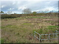
A Balancing Pond, apparently
At least, that's what the map describes it as; not much water in it at the moment. It's presumably an urban drainage pond built at the time of the adjoining Honeysuckle Grange housing estate, intended to take surface runoff water and store it for later release into the nearest watercourse.
Image: © Richard Law
Taken: 30 Nov 2021
0.03 miles
3
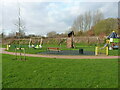
A small children's play area
Small play area for small children.
Image: © Richard Law
Taken: 30 Nov 2021
0.06 miles
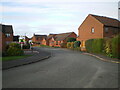
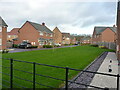
4
Admirals Way houses
Part of the housing estate on the NE side of Shifnal
Image: © Richard Law
Taken: 24 Nov 2021
0.07 miles
6
The far end of Alder Road
Houses at the furthest end of Alder Road, with the M54 motorway in a cutting in the trees on the right.
Image: © Richard Law
Taken: 30 Nov 2021
0.09 miles
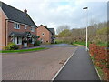
7
Looking west along Meadow Drive
1970s housing on the estate at the NE corner of Shifnal
Image: © Richard Law
Taken: 24 Nov 2021
0.09 miles
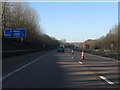
9
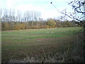
Field and motorway cutting
The open field here serves to distance the most northerly houses on Admirals Park from the M54 motorway, which runs in the cutting with the trees at the far side.
Image: © Richard Law
Taken: 24 Nov 2021
0.10 miles
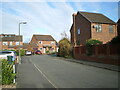
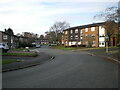
10
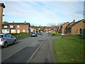
Balfour Road
Looking north along the main part of Balfour Road, with Beatty Close on the right.
Image: © Richard Law
Taken: 24 Nov 2021
0.12 miles