
IMAGES TAKEN NEAR TO
Wallshead Way, NEWPORT, TF10 9LP
Introduction
This page details the photographs taken nearby to Wallshead Way, TF10 9LP by members of the Geograph project.
The Geograph project started in 2005 with the aim of publishing, organising and preserving representative images for every square kilometre of Great Britain, Ireland and the Isle of Man.

There are currently over 7.5m images from over14,400 individuals and you can help contribute to the project by visiting https://www.geograph.org.uk
Image Map
Images are licensed for reuse under creativecommons.org/licenses/by-sa/2.0
Notes
- Clicking on the map will re-center to the selected point.
- The higher the marker number, the further away the image location is from the centre of the postcode.
Image Listing (8 Images Found)
Images are licensed for reuse under creativecommons.org/licenses/by-sa/2.0
Image
Details
Distance
1
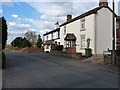
Cottages at the northern end of Dark Lane
Nearly at the junction with Wellington Road, the old A518 into Newport.
Image: © Richard Law
Taken: 4 Apr 2013
0.18 miles
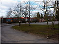
3
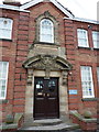
The main entrance door - Newport Girls' High School
The carved plaque, sporting the old 3-heads on a shield symbol of the council, above the entrance reads:-
Salop County Council
Girls High School
1920
Image: © Richard Law
Taken: 4 Apr 2013
0.21 miles
4
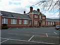
Newport Girls High School
A former Grammar School for girls, founded in 1920. It is one of the three large and respected schools in the town, and now runs under Academy Trust status, specialising in Maths, Computing and Science.
http://www.nghs.co.uk/
Much of the curriculum and facilities are shared with the Adam's Grammar boys' school a little further north. That dates from the 1650s, and is seen in the background of Image
Image: © Richard Law
Taken: 4 Apr 2013
0.22 miles
5
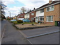
Dark Lane, Church Aston
1970s or '80s semis on Dark Lane.
Image: © Richard Law
Taken: 4 Apr 2013
0.23 miles
6

Village Hall
I have just missed the 'Table Top Sale'.
Image: © John M
Taken: 8 Jun 2013
0.23 miles
7
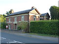
1 Station Road, Newport
Built around 1838 as the Station Master's house, and Grade II listed https://britishlistedbuildings.co.uk/101367315-1-station-road-newport#.W6ePvNQrLGg in 1978. The station lay at approximately SJ75011833, maybe 100 yards away to the ESE of here, on the former Wellington to Stafford branch of the Shropshire Union Railway and Canal Company line, later taken over by the London and North Western Railway, and which closed to passenger traffic in early September 1964.
Image: © Richard Law
Taken: 21 Aug 2018
0.24 miles
8
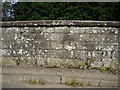
Ordnance Survey bench-mark on former railway bridge
This bench mark was established in 1858 during the First primary levelling, England & Wales, and was levelled with a height of 282.7170 feet [86.1721 metres] above mean sea level (Liverpool datum). It was included as a side level on the Llandysilio to Stafford levelling line. The surveyor's description was No. 84(a). Church Aston Bridge, over railway. Mark on North battlement ; 1.41 ft. above surface (p587).
Image: © Shantavira
Taken: 16 Aug 2013
0.25 miles