
IMAGES TAKEN NEAR TO
Lilleshall, NEWPORT, TF10 9JA
Introduction
This page details the photographs taken nearby to TF10 9JA by members of the Geograph project.
The Geograph project started in 2005 with the aim of publishing, organising and preserving representative images for every square kilometre of Great Britain, Ireland and the Isle of Man.

There are currently over 7.5m images from over14,400 individuals and you can help contribute to the project by visiting https://www.geograph.org.uk
Image Map
Images are licensed for reuse under creativecommons.org/licenses/by-sa/2.0
Notes
- Clicking on the map will re-center to the selected point.
- The higher the marker number, the further away the image location is from the centre of the postcode.
Image Listing (34 Images Found)
Images are licensed for reuse under creativecommons.org/licenses/by-sa/2.0
Image
Details
Distance
1
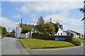
Old Hall
Housing development in the grounds of the Old Hall.
Image: © John M
Taken: 8 Jun 2013
0.03 miles
2
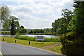
Fish pond at the Old Hall
Did this also power a mill downstream?
Image: © John M
Taken: 8 Jun 2013
0.05 miles
3
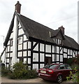
9 Church Road, Lilleshall
Originally a range of 16th/17 century cottages, but now converted to a single house, which was Grade II listed https://britishlistedbuildings.co.uk/101374544-9-church-road-lilleshall-and-donnington#.X13dbWhKjcs & https://historicengland.org.uk/listing/the-list/list-entry/1374544 in 1983.
Image: © Richard Law
Taken: 30 Aug 2020
0.06 miles
4
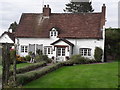
The Cottage, Church Road, Lilleshall
The Cottage is composed of a 17th century timber frame under an 18th century brick facing, with a slightly more recent porch added to the frontage. The whole was Grade II listed https://britishlistedbuildings.co.uk/101374543-the-cottage-lilleshall-and-donnington#.X1zUnmhKjcs & https://historicengland.org.uk/listing/the-list/list-entry/1374543 in 1983.
Image: © Richard Law
Taken: 30 Aug 2020
0.09 miles
5
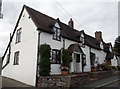
Honeysuckle Cottage & Mill House, Lilleshall
Behind the 19th century brick and render facing lies a pair of 17th century timber-framed cottages, which attracted a collective Grade II listing https://britishlistedbuildings.co.uk/101038246-honeysuckle-cottagemill-house-lilleshall-and-donnington#.X13ekWhKjcs & https://historicengland.org.uk/listing/the-list/list-entry/1038246 in 1983.
Image: © Richard Law
Taken: 30 Aug 2020
0.09 miles
6
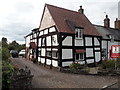
2 Church Road, Lilleshall
The obvious single-bay timber framed cottage here dates from the 16th century (there's a later addition at the far end) and was Grade II listed https://britishlistedbuildings.co.uk/101038244-the-shiel-lilleshall-and-donnington#.X1zR9WhKjcs & https://historicengland.org.uk/listing/the-list/list-entry/1038244 in 1983. The listing also includes Image, partly hidden offshot to the right behind the estate agency board.
Image: © Richard Law
Taken: 30 Aug 2020
0.10 miles
8
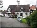
Tudor Cottage, Lilleshall
17th century in origin, and timber-framed beneath the more recent plastering. It was Grade II listed https://britishlistedbuildings.co.uk/101038243-tudor-cottage-lilleshall-and-donnington#.X1vGB2hKjcs & https://historicengland.org.uk/listing/the-list/list-entry/1038243 in 1983.
Image: © Richard Law
Taken: 30 Aug 2020
0.11 miles
9
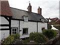
The Shiel, Church Road, Lilleshall
Now known as Cobweb Cottage, but referred to as The Shiel in 1983 when it was included in the Grade II listing https://britishlistedbuildings.co.uk/101038244-the-shiel-lilleshall-and-donnington#.X1zR9WhKjcs & https://historicengland.org.uk/listing/the-list/list-entry/1038244 which it shares with the adjoining cottage Image
Image: © Richard Law
Taken: 30 Aug 2020
0.11 miles
10
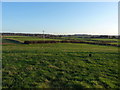
Little-used footpath towards Lilleshall Grange and the abbey
Image: © Richard Law
Taken: 15 Jan 2012
0.13 miles