IMAGES TAKEN NEAR TO
Flashbrook, NEWPORT, TF10 8DR
Introduction
This page details the photographs taken nearby to TF10 8DR by members of the Geograph project.
The Geograph project started in 2005 with the aim of publishing, organising and preserving representative images for every square kilometre of Great Britain, Ireland and the Isle of Man.

There are currently over 7.5m images from over14,400 individuals and you can help contribute to the project by visiting https://www.geograph.org.uk
Image Map
Images are licensed for reuse under creativecommons.org/licenses/by-sa/2.0
Notes
- Clicking on the map will re-center to the selected point.
- The higher the marker number, the further away the image location is from the centre of the postcode.
Image Listing (7 Images Found)
Images are licensed for reuse under creativecommons.org/licenses/by-sa/2.0
Image
Details
Distance
1
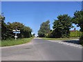
Crossroads at Camp Farm
A minor road follows a section of the Via Devana, the Roman road from Colchester to Chester for three kilometres, a short way to the north of Newport and forms the historical boundary between Shropshire (now Telford and Wrekin) and Staffordshire. Here, at Camp Farm (probably a name with a Roman origin) a minor road crosses. The blue signs indicate National Cycle Network Route 55.
Image: © Oliver Dixon
Taken: 16 Jun 2010
0.02 miles
3
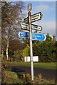
Old Direction Sign - Signpost by Camp Crossroads, Cheswardine Parish
Annulus finial - 4 Worboys arms; Shropshire CC modern halo by the UC road, in parish of Cheswardine (North Shropshire District), Camp Crossroads.
Surveyed
Milestone Society National ID: SA_SJ7324.
Image: © Milestone Society
Taken: Unknown
0.04 miles

5
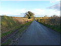
Roman Road from Chester to Colchester
A section of the Via Devana road from Deva (Chester) towards Colonia Victricensis (Colchester), which here heads more or less directly to Pennocrucium, the settlement in Image just off Watling Street near Penkridge.
Image: © Richard Law
Taken: 22 Nov 2014
0.13 miles