
IMAGES TAKEN NEAR TO
Stafford Street, NEWPORT, TF10 7LT
Introduction
This page details the photographs taken nearby to Stafford Street, TF10 7LT by members of the Geograph project.
The Geograph project started in 2005 with the aim of publishing, organising and preserving representative images for every square kilometre of Great Britain, Ireland and the Isle of Man.

There are currently over 7.5m images from over14,400 individuals and you can help contribute to the project by visiting https://www.geograph.org.uk
Image Map
Images are licensed for reuse under creativecommons.org/licenses/by-sa/2.0
Notes
- Clicking on the map will re-center to the selected point.
- The higher the marker number, the further away the image location is from the centre of the postcode.
Image Listing (192 Images Found)
Images are licensed for reuse under creativecommons.org/licenses/by-sa/2.0
Image
Details
Distance
1
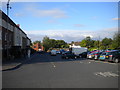
Bus interchange, Newport
Presumably so named because one can hardly describe three bus shelters in a car park as a "bus station".
Image: © Richard Vince
Taken: 19 Jun 2015
0.03 miles
2
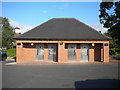
Public toilets, Stafford Street car park, Newport
Image: © Richard Vince
Taken: 19 Jun 2015
0.04 miles
3
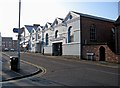
Market Hall (Stafford Street frontage)
There is still an indoor market here on Fridays & Saturdays, with the entrance by the door under the sign "Newport Market". Much of the ground floor is used by individual shops.
Image
Image: © P L Chadwick
Taken: 6 Feb 2010
0.04 miles
4
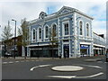
The former Newport Town Hall
Built in 1860 to a design by J Cobb, described as 'debased Italianate style', and originally used as the Town Hall. It was Grade II listed https://britishlistedbuildings.co.uk/101367292-former-town-hall-owners-newport-salop-market-and-trading-company-newport#.YGeSpuhKjIU & https://historicengland.org.uk/listing/the-list/list-entry/1367292 in 1978, and the ground floor at least is now a series of shops.
Image: © Richard Law
Taken: 29 Mar 2021
0.04 miles
5
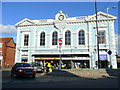
Town Hall, Newport
A good solid Victorian (1860) structure in this prosperous market town.
A nice shade of sky blue!
Image: © Jonathan Billinger
Taken: 21 Oct 2008
0.04 miles
6
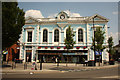
Newport Town Hall
Italianate former Town Hall now shops, by local architect John Cobb of Chetwyn End in 1860.
Image: © Richard Croft
Taken: 17 Jul 2013
0.04 miles
7
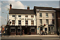
Barley Mow & Boughey House
Grade II listed buildings on Newport High Street
The Barley Mow http://www.thebarleynewport.co.uk/ is a 19th century brick building around a 17th century timber-frame.
Boughey House is one of the oldest buildings in Newport, a 16th century timber-frame encased in a late 18th century stucco façade. Sir Thomas and Lady Annabelle Boughey were great benefactors of Newport. Sir Thomas died in 1906 and the Boughey Trust was established the same year, the solicitors concerned were Liddle & Heane who had occupied the premises since 1856.
Image: © Richard Croft
Taken: 17 Jul 2013
0.05 miles
8
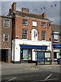
54 High Street, Newport
A Regency building of some style, which once had a distinguished doorcase and a bow window when it was a house; it was Grade II listed https://britishlistedbuildings.co.uk/101054366-54-high-street-newport & https://historicengland.org.uk/listing/the-list/list-entry/1054366 in 1952.
Image: © Richard Law
Taken: 1 May 2023
0.05 miles
9
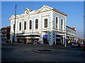
Market Hall (High Street frontage)
According to the Town Council's Town Guide, the Market Hall was erected in 1860 as a corn exchange, with indoor and outdoor market facilities, and with an assembly room on the first floor. It has had no civic function since 1963. The Town Council themselves are based in the Guildhall. Their guide also makes the point that the Market Hall "is frequently mis-quoted as the Town Hall". Today on the ground floor there are a series of small shops.
Image
Image: © P L Chadwick
Taken: 6 Feb 2010
0.05 miles
10
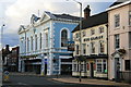
The Barley
The Barley public house is on the corner of Newport High Street and Stafford Street.
Image: © David Rogers
Taken: 14 Aug 2008
0.05 miles