
IMAGES TAKEN NEAR TO
Salters Lane, NEWPORT, TF10 7LB
Introduction
This page details the photographs taken nearby to Salters Lane, TF10 7LB by members of the Geograph project.
The Geograph project started in 2005 with the aim of publishing, organising and preserving representative images for every square kilometre of Great Britain, Ireland and the Isle of Man.

There are currently over 7.5m images from over14,400 individuals and you can help contribute to the project by visiting https://www.geograph.org.uk
Image Map
Images are licensed for reuse under creativecommons.org/licenses/by-sa/2.0
Notes
- Clicking on the map will re-center to the selected point.
- The higher the marker number, the further away the image location is from the centre of the postcode.
Image Listing (160 Images Found)
Images are licensed for reuse under creativecommons.org/licenses/by-sa/2.0
Image
Details
Distance
1

Newport Fire Station, Salters Lane
The fire station run by Shropshire Fire & Rescue Service.
Another view:- Image
Image: © P L Chadwick
Taken: 6 Feb 2010
0.02 miles
2
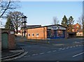
Newport Fire Station and drill tower, Salters Lane
Located on the corner of Salters Lane, and Waterside Mews.
Another view of the fire station:- Image
Image: © P L Chadwick
Taken: 6 Feb 2010
0.02 miles
3
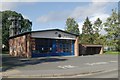
Newport fire station
Newport fire station, Salters Lane, Newport, Shropshire.
Image: © Kevin Hale
Taken: 21 Oct 2006
0.04 miles
4
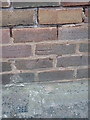
OS benchmark - Newport, Salters Lane school
An OS cutmark in the bricks of a former school in Salters Lane; originally levelled at 67.64m above Ordnance Datum Newlyn.
Image: © Richard Law
Taken: 14 Mar 2014
0.04 miles
6
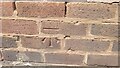
Salters Court School Benchmark
The school is on Salter's Lane, Newport, Shropshire. The Benchmark is accessible from the roadside pavement. The Benchmark was last verified by the OS in 1961
Image: © Anthony Rowley
Taken: 15 Jun 2022
0.05 miles
7
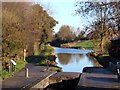
Newport Lock and canal
This photograph was taken after the extensive clean-up.
Image: © Roger Dean
Taken: 16 Dec 2006
0.07 miles
8

Newport canal basin
A view across the canal basin towards "Fishers Lock.
Image: © Roger Dean
Taken: 16 Dec 2006
0.07 miles
9
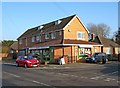
Costcutter local supermarket, 5 Salters Lane
This local convenience store is located on the corner of Salters Lane and Beaumaris Road.
Image: © P L Chadwick
Taken: 6 Feb 2010
0.08 miles
10
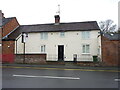
1 Salter's Lane, Newport
This house on Salter's Lane was built in the early 18th century and attracted a Grade II listing https://britishlistedbuildings.co.uk/101054339-1-salters-lane-newport#.YNOcMehKjIU & https://historicengland.org.uk/listing/the-list/list-entry/1054339 in 1978 for 'group value' with other nearby premises of similar vintage.
Image: © Richard Law
Taken: 9 Apr 2021
0.08 miles