
IMAGES TAKEN NEAR TO
Lower Bar, NEWPORT, TF10 7JA
Introduction
This page details the photographs taken nearby to Lower Bar, TF10 7JA by members of the Geograph project.
The Geograph project started in 2005 with the aim of publishing, organising and preserving representative images for every square kilometre of Great Britain, Ireland and the Isle of Man.

There are currently over 7.5m images from over14,400 individuals and you can help contribute to the project by visiting https://www.geograph.org.uk
Image Map
Images are licensed for reuse under creativecommons.org/licenses/by-sa/2.0
Notes
- Clicking on the map will re-center to the selected point.
- The higher the marker number, the further away the image location is from the centre of the postcode.
Image Listing (158 Images Found)
Images are licensed for reuse under creativecommons.org/licenses/by-sa/2.0
Image
Details
Distance
1
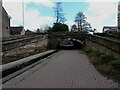
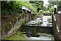
Roving bridge on the former Newport Canal
The whole area around this roving bridge and former lock on the canal was designated in 1968 as a Scheduled (Ancient) Monument, dating from 1835/36. The full details of the designation can be found at https://historicengland.org.uk/listing/the-list/list-entry/1002952
Image: © Richard Law
Taken: 29 Mar 2021
0.01 miles
2
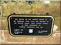
Plaque recording restoration of section of Newport Canal
This plaque is affixed to the wall of the bridge carrying the nearby road across the canal. The Urban District Council responsible was re-organised out of existence decades ago. Interestingly, the traditional contraction of Shropshire to Salop, was also abandoned around the time the UK joined the European Union in 1973. Nowadays Shrops is the preferred alternative, as the older word causes considerable amusement to French speakers. Anyone with a good French dictionary will be able to see why.
Image
Image: © P L Chadwick
Taken: 6 Feb 2010
0.01 miles
3
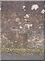
OS benchmark - Newport, canal bridge, Lower Bar
An OS benchmark in the parapet of the bridge over the canal at Lower Bar; originally levelled at 68.10m above Ordnance Datum Newlyn.
Image: © Richard Law
Taken: 14 Mar 2014
0.01 miles
4
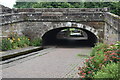
Town Bridge, Newport
At this point the former Shrewsbury and Newport Canal has been reduced to a narrow ornamental channel.
Image: © David Martin
Taken: 30 Jul 2022
0.01 miles
6

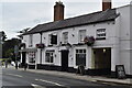
The Bridge Inn
At Chetwynd End in Newport.
Image: © David Rogers
Taken: 14 May 2009
0.02 miles
8
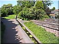
Newport Canal
Seen from the town bridge. The Shrewsbury and Newport Canal (which has been known variously as the Shrewsbury, and as the Newport Canal) connected Shrewsbury with the main line of the Shropshire Union Canal at Norbury Junction. The last link between Wappenshall (near Telford) and Norbury Junction through Newport was only completed in 1835. The Canal was abandoned in 1944. The section within Newport town has recently been restored as an amenity - but obviously not as a navigable waterway.
Image: © Oliver Dixon
Taken: 17 Jun 2010
0.03 miles
9
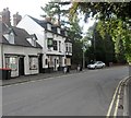
The Bridge Inn
At Newport in Shropshire.
Image: © James Denham
Taken: 30 Aug 2010
0.03 miles
10
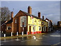
The Swan, Newport
Banks's by the old canal wharf with skittles
Image: © al partington
Taken: 27 Feb 2007
0.03 miles