
IMAGES TAKEN NEAR TO
Upper Bar, NEWPORT, TF10 7EJ
Introduction
This page details the photographs taken nearby to Upper Bar, TF10 7EJ by members of the Geograph project.
The Geograph project started in 2005 with the aim of publishing, organising and preserving representative images for every square kilometre of Great Britain, Ireland and the Isle of Man.

There are currently over 7.5m images from over14,400 individuals and you can help contribute to the project by visiting https://www.geograph.org.uk
Image Map
Images are licensed for reuse under creativecommons.org/licenses/by-sa/2.0
Notes
- Clicking on the map will re-center to the selected point.
- The higher the marker number, the further away the image location is from the centre of the postcode.
Image Listing (91 Images Found)
Images are licensed for reuse under creativecommons.org/licenses/by-sa/2.0
Image
Details
Distance
1
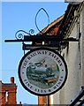
The Railway Tavern sign, 62 Upper Bar
One of Newport's many pubs. Image
Image: © P L Chadwick
Taken: 6 Feb 2010
0.00 miles
2
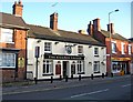
The Railway Tavern, 62 Upper Bar
The railway has long gone from Newport, but this pub is a reminder that it once reached here. It is one of a strange set of ill-assorted neighbours - a solicitor's office on one side, and a tattoo studio on the other.
A close-up of the current sign:- Image
Image: © P L Chadwick
Taken: 6 Feb 2010
0.00 miles
3
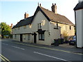
9 & 11 Upper Bar, Newport
Grade II listed https://britishlistedbuildings.co.uk/101054341-9-and-11-upper-bar-newport#.W6eVLdQrLGg in 1978, the 19th century roughcast outer hides a much earlier timber-framed house, possibly 17th century - I would speculate that the nearest portion facing the road would once have been a fine jettied gable.
Image: © Richard Law
Taken: 21 Aug 2018
0.02 miles
4

Upper Bar, Newport, Shrops
Looking south southeast from outside The Railway Tavern.
Image: © P L Chadwick
Taken: 3 Mar 2025
0.02 miles
5
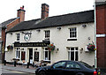
The Railway Tavern, Newport, Shropshire
The Railway Tavern, Newport, Shropshire. This pub has had a repaint and a great railway wall sign has been destroyed. Image
Image: © Gordon Cragg
Taken: 5 Aug 2009
0.02 miles
6
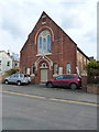
Newport C of E church
A foundation stone, at the foot of the buttress behind the red car, states that it was laid by E. Crapper, Esq on July 17th 1876.
Image: © Richard Law
Taken: 4 Apr 2013
0.04 miles
7

Properties in Upper Bar, Newport, Shrops
On the left is a property in residential use, next is Golden Shop Vape Sweets Ltd., and next door to that is a shop which when photographed was undergoing renovation.
Image: © P L Chadwick
Taken: 3 Mar 2025
0.04 miles
8

Junction of roads at Upper Bar, Newport, Shrops
On the right is the Shakespeare Inn. The road coming in from the right by this building is Avenue Road. On the left of Upper Bar, the road coming in from the left is Wellington Road.
Image: © P L Chadwick
Taken: 3 Mar 2025
0.05 miles
9
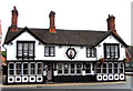
The Shakespeare Inn, Newport, Shropshire
Front view of The Shakespeare Inn, Newport, Shropshire
Image: © Gordon Cragg
Taken: 5 Aug 2009
0.05 miles
10
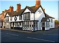
The Shakespeare Inn, 66 Upper Bar
The connection between William Shakespeare and Newport in Shropshire is unknown, but this inn is named after him. Next door is The Pheasant Inn.
Image: © P L Chadwick
Taken: 6 Feb 2010
0.05 miles