
IMAGES TAKEN NEAR TO
Powell Place, NEWPORT, TF10 7BS
Introduction
This page details the photographs taken nearby to Powell Place, TF10 7BS by members of the Geograph project.
The Geograph project started in 2005 with the aim of publishing, organising and preserving representative images for every square kilometre of Great Britain, Ireland and the Isle of Man.

There are currently over 7.5m images from over14,400 individuals and you can help contribute to the project by visiting https://www.geograph.org.uk
Image Map
Images are licensed for reuse under creativecommons.org/licenses/by-sa/2.0
Notes
- Clicking on the map will re-center to the selected point.
- The higher the marker number, the further away the image location is from the centre of the postcode.
Image Listing (112 Images Found)
Images are licensed for reuse under creativecommons.org/licenses/by-sa/2.0
Image
Details
Distance
2
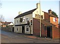
The New Inn, 2 Stafford Road
Stafford Road is the continuation of Stafford Street. This popular pub is older than it looks from the outside, and is believed to date from 1792. It still has some remains of its old stables, and a very old cellar. At the back is a beer garden. The oval sign to the right of the Union Jack flag is a sign for Caffrey's Irish Ale.
Image: © P L Chadwick
Taken: 6 Feb 2010
0.07 miles
3
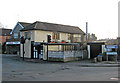
Buildings in Audley Road
The building on the left is Jones Fish & Chips. The building on the right has two front doors, and a sign with the name Traditions. Presumably part of the building is a private residence, and part is used for business purposes.
Image: © P L Chadwick
Taken: 6 Feb 2010
0.09 miles
4
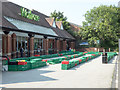
Coronavirus Entrance Chicane: Waitrose
During the coronavirus pandemic, customers are expected to keep 2 metres apart and supermarkets have adopted various means of managing the consequent queues. This is the solution adopted by Waitrose, Newport, Shropshire
Image: © Mike White
Taken: 24 Jun 2020
0.10 miles
5
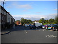
Bus interchange, Newport
Presumably so named because one can hardly describe three bus shelters in a car park as a "bus station".
Image: © Richard Vince
Taken: 19 Jun 2015
0.11 miles
6
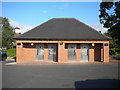
Public toilets, Stafford Street car park, Newport
Image: © Richard Vince
Taken: 19 Jun 2015
0.12 miles
7
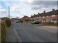
Meadow Road, Newport
1950s & 60s housing on the Audley estate on the east side of Newport.
Image: © Richard Law
Taken: 4 Apr 2013
0.14 miles
8
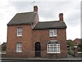
Old Toll House, Stafford Road, Newport
Toll House in the parish of Newport, at 46, Stafford Road.
Shropshire HER.
HER Number (PRN): 15336. https://www.heritagegateway.org.uk/Gateway/Results_Single.aspx?uid=MSA17239&resourceID=1015
To be surveyed
Milestone Society National ID: SA.NPT
Image: © Milestone Society
Taken: Unknown
0.15 miles
9
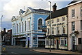
The Barley
The Barley public house is on the corner of Newport High Street and Stafford Street.
Image: © David Rogers
Taken: 14 Aug 2008
0.18 miles
10
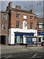
54 High Street, Newport
A Regency building of some style, which once had a distinguished doorcase and a bow window when it was a house; it was Grade II listed https://britishlistedbuildings.co.uk/101054366-54-high-street-newport & https://historicengland.org.uk/listing/the-list/list-entry/1054366 in 1952.
Image: © Richard Law
Taken: 1 May 2023
0.18 miles