
IMAGES TAKEN NEAR TO
Pine Trees, NEWPORT, TF10 7AS
Introduction
This page details the photographs taken nearby to Pine Trees, TF10 7AS by members of the Geograph project.
The Geograph project started in 2005 with the aim of publishing, organising and preserving representative images for every square kilometre of Great Britain, Ireland and the Isle of Man.

There are currently over 7.5m images from over14,400 individuals and you can help contribute to the project by visiting https://www.geograph.org.uk
Image Map
Images are licensed for reuse under creativecommons.org/licenses/by-sa/2.0
Notes
- Clicking on the map will re-center to the selected point.
- The higher the marker number, the further away the image location is from the centre of the postcode.
Image Listing (73 Images Found)
Images are licensed for reuse under creativecommons.org/licenses/by-sa/2.0
Image
Details
Distance
1
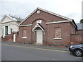
The old British School, Wellington Road, Newport, Shropshire
Dating to 1841 if my somewhat sketchy recollection of Roman numerals is accurate. Shame about the bricked up windows.
Image: © Jeremy Bolwell
Taken: 12 Sep 2012
0.04 miles
2
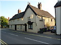
9 & 11 Upper Bar, Newport
Grade II listed https://britishlistedbuildings.co.uk/101054341-9-and-11-upper-bar-newport#.W6eVLdQrLGg in 1978, the 19th century roughcast outer hides a much earlier timber-framed house, possibly 17th century - I would speculate that the nearest portion facing the road would once have been a fine jettied gable.
Image: © Richard Law
Taken: 21 Aug 2018
0.05 miles
3
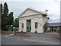
Trinity Church, Newport , Shropshire
Now a combined United Reformed Church and Methodist chapel by the signage. Nice glass door. Undergoing a bit of work by the look of things. What is the medium to long term future of these places of worship in our largely secularised society?
Image: © Jeremy Bolwell
Taken: 12 Sep 2012
0.05 miles
4
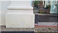
United Reformed Church Benchmark
Ordnance Survey Benchmark cut into United Reformed Church on Wellington Road, Newport, Shropshire. It was last verified by the OS in 1961
Image: © Anthony Rowley
Taken: 15 Jun 2022
0.05 miles
5
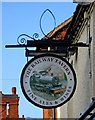
The Railway Tavern sign, 62 Upper Bar
One of Newport's many pubs. Image
Image: © P L Chadwick
Taken: 6 Feb 2010
0.06 miles
6
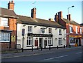
The Railway Tavern, 62 Upper Bar
The railway has long gone from Newport, but this pub is a reminder that it once reached here. It is one of a strange set of ill-assorted neighbours - a solicitor's office on one side, and a tattoo studio on the other.
A close-up of the current sign:- Image
Image: © P L Chadwick
Taken: 6 Feb 2010
0.06 miles
7

Upper Bar, Newport, Shrops
Looking south southeast from outside The Railway Tavern.
Image: © P L Chadwick
Taken: 3 Mar 2025
0.07 miles
8
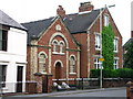
Masonic Hall, Newport.
On Wellington Road in Newport.
Image: © David Rogers
Taken: 14 May 2009
0.07 miles
9
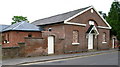
British School, Newport
Erected on Wellington Road by voluntary contributions.
Image: © David Rogers
Taken: 14 May 2009
0.07 miles
10
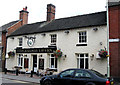
The Railway Tavern, Newport, Shropshire
The Railway Tavern, Newport, Shropshire. This pub has had a repaint and a great railway wall sign has been destroyed. Image
Image: © Gordon Cragg
Taken: 5 Aug 2009
0.07 miles