IMAGES TAKEN NEAR TO
Eschiehaugh, KELSO, TD5 7SJ

Introduction

This page details the photographs taken nearby to Eschiehaugh, TD5 7SJ by members of the Geograph project.

The Geograph project started in 2005 with the aim of publishing, organising and preserving representative images for every square kilometre of Great Britain, Ireland and the Isle of Man.

There are currently over 7.5m images from over14,400 individuals and you can help contribute to the project by visiting https://www.geograph.org.uk

Image Map


Images are licensed for reuse under creativecommons.org/licenses/by-sa/2.0
Notes
  • Clicking on the map will re-center to the selected point.
  • The higher the marker number, the further away the image location is from the centre of the postcode.

Image Listing (20 Images Found)

Images are licensed for reuse under creativecommons.org/licenses/by-sa/2.0
Image
Details
Distance
1
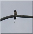
A Sad Tail
This wee Swallow and his mate have been with us for the past 3 summers where they have raised some 28 young. I recognise them due to the missing tail streamer. This year they arrived home very early on the 4th of April, (it is normally nearer the 20th). While watching them exploring their home territory after their mammoth 12000mile journey back from South Africa I was somewhat dismayed to watch the local Sparrowhawk take one of them. The picture above shows the male singing his little heart out looking for his life long mate. April 20th he found a new mate, and by the 1st May the nest has been made and lined, no eggs as yet!
Image: © Hill Walker Taken: 10 Apr 2007
0.08 miles
2
Kelso Fire Station
The station is situated in Eschiehaugh Park on the east side of the town.
Image: © Walter Baxter Taken: 16 Oct 2009
0.12 miles
3
Dryinghouse Lane
Road leaving Kelso and passing the fire station. The woodland (Broomlands Bank Plantation) would once have been outside the town.
Image: © Richard Webb Taken: 2 Jul 2010
0.14 miles
4
River Tweed - Floods of January 2005
Looking downstream from the new bridge, This was the biggest river since 1948.
Image: © Hill Walker Taken: 8 Jan 2005
0.18 miles
5
Mini roundabout on Golf Course Road. Kelso
Image: © JThomas Taken: 5 May 2016
0.18 miles
6
Trees beside the B6461, Kelso
Image: © JThomas Taken: 5 May 2016
0.19 miles
7
Rosebank Cemetery, Kelso
The cemetery, known by the Commonwealth War Graves Commission as simply Kelso Cemetery, on the Duns road, at the junction of Shedden Park Road and Dryinghouse Lane, belongs to the Town Council.
Image: © Russel Wills Taken: 31 Aug 2021
0.19 miles
8
Bungalow on Golf Course Road. Kelso
Image: © JThomas Taken: 5 May 2016
0.19 miles
9
Kelso Health Centre
The Health Centre on Inch Road, Kelso.
Image: © Jim Barton Taken: 17 Dec 2021
0.20 miles
10
Rosebank Cemetery
On the road out of Kelso towards Coldstream.
Image: © Richard Webb Taken: 3 Sep 2011
0.20 miles