1
Pier Road
Looking across to Pier Road from Berwick Pier. The building to the left of centre is Pier Maltings, dating from around 1838 with 19th and 20th Century extension and conversion. Grade II listed - see www.historicengland.org.uk/listing/the-list/list-entry/1391849.
Image: © Ian Capper
Taken: 25 Sep 2020
0.00 miles
2
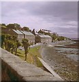
View along the north shore of the Tweed, from Fisher's Fort, Berwick, 1969
A photo taken in morning light, looking seaward from the fort walls https://www.geograph.org.uk/photo/775216 I don't doubt that it was the roof of
Image that caught my eye and prompted this shot. My camera was a boxy Kodak Instamatic.
I was in Berwick a few days before the Apollo 11 moon-landing. A recent view
Image suggests that not a lot has changed in half a century, though there are now more cars (and perhaps fewer trees).
Image scanned from a print. I've attempted to correct a reddish bias that's crept in over the years, but haven't altogether succeeded.
Image: © Stefan Czapski
Taken: 19 Jul 1969
0.01 miles
3
Pier Road, Berwick-upon-Tweed
Looking upstream along the River Tweed, from the bend in the breakwater, towards the old maltings and terraces of houses above the bay.
Image: © M J Richardson
Taken: 3 Jul 2015
0.01 miles
4
Pier Road, Berwick
Note the complete lack of barrier for most of the road, which leads to a car park for the beach.
Image: © Bill Harrison
Taken: 24 Jul 2017
0.01 miles
5
Pier Road View
Viewed from the harbour on a disappointingly dull spell of September weather.
Image: © Mary and Angus Hogg
Taken: 25 Sep 2018
0.01 miles
6
Coast guard houses and Deavon Terrace, Berwick
Terrace of houses with a commanding view of the Tweed Estuary and coastline south to the Farnes.
Image: © Stafford Little
Taken: 8 Jan 2006
0.01 miles
7
View from the ramparts
Image: © Stuart Wilding
Taken: 10 May 2017
0.02 miles
8
Post Box, Pier Road, Berwick-upon-Tweed
This wall mounted box dates from the reign of Edward VII who was on the throne from 22 January 1901 until his death on 6 May 1910. The earliest Edwardian boxes were modified from the last Victorian designs, of which this is an example, but midway through his reign the elaborate scroll cipher of Edward VII began to appear on post boxes.
Image: © Geoff Holland
Taken: 21 Sep 2022
0.02 miles
9
Houses at Pier Road, Berwick-upon-Tweed
The houses were viewed from a boat on the Tweed Estuary.
Image: © Walter Baxter
Taken: 15 Sep 2018
0.02 miles
10
Pier Road, Berwick-upon-Tweed
Image: © Stuart Wilding
Taken: 10 May 2017
0.02 miles


