IMAGES TAKEN NEAR TO
Ladhope Vale, GALASHIELS, TD1 1BT

Introduction

This page details the photographs taken nearby to Ladhope Vale, TD1 1BT by members of the Geograph project.

The Geograph project started in 2005 with the aim of publishing, organising and preserving representative images for every square kilometre of Great Britain, Ireland and the Isle of Man.

There are currently over 7.5m images from over14,400 individuals and you can help contribute to the project by visiting https://www.geograph.org.uk

Image Map


Images are licensed for reuse under creativecommons.org/licenses/by-sa/2.0
Notes
  • Clicking on the map will re-center to the selected point.
  • The higher the marker number, the further away the image location is from the centre of the postcode.

Image Listing (716 Images Found)

Images are licensed for reuse under creativecommons.org/licenses/by-sa/2.0
  • ...
Image
Details
Distance
1
Chapel Street, Galashiels
Stone cottages with a path alongside and the former Ladhope Kirk in the background. Compare with Image
Image: © Jim Barton Taken: 6 Feb 2015
0.02 miles
2
A train on the Borders Railway
Trains have been running on a normal timetable during the Coronavirus lockdown with hardly any passengers and most carriages are usually empty. This Edinburgh bound train was viewed from Ladhope Vale as it left Galashiels Station.
Image: © Walter Baxter Taken: 12 May 2020
0.03 miles
3
The Black Path at Ladhope Vale
This footpath, known locally as the Black Path, runs on the route of the former Waverley Railway Line from Wheatlands Road in Galashiels to Tweedbank. The Waverley Line was closed in 1969 but it is planned to reopen on this path as a single track line. However, the Waverley Railway Bill stipulates that any paths severed by the line must be replaced with a functional alternative. Time will tell. The retaining wall on the left was built after a landslide in 1916.
Image: © Walter Baxter Taken: 2 Sep 2007
0.03 miles
4
A Galashiels roofscape
The bellcote of the former Ladhope Church is on the right with the reduced spire of the former St Andrew’s Church behind. For a view of the original St Andrew’s spire, see Image This was viewed in late December from the High Road Park.
Image: © Walter Baxter Taken: 26 Dec 2014
0.03 miles
5
St Aidan's Church steeple, Galashiels
This is a view from the east end of the High Road over the roof tops of the town to the church steeple in Gala Park. The church closed in 2006 when its congregation merged with that of St Ninians. A developer has plans to create flats on the site of the Category B listed building, but nothing has happened as yet.
Image: © Walter Baxter Taken: 29 Aug 2009
0.03 miles
6
Ladhope Vale (A7), Galashiels
Looking north west.
Image: © JThomas Taken: 6 Jul 2017
0.04 miles
7
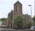
The former St. Andrew's Church in Galashiels.
Situated in Bridge Street, the church is now an Arts Centre.
Image: © James Denham Taken: 8 Oct 2008
0.04 miles
8
High Street, Galashiels
Image: © James Denham Taken: 6 Jul 2010
0.04 miles
9
Mac Arts Centre, Galashiels
Formerly St Andrew's Church in Bridge Street, now the Mac Arts Centre, a venue for theatre and music.
Image: © Jim Barton Taken: 9 May 2019
0.04 miles
10
Former church on Bridge Street, Galashiels
Image: © Ian S Taken: 5 Jan 2020
0.04 miles
  • ...